Area Overview for BH11 8TF
Photos of BH11 8TF
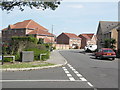
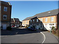
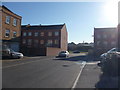
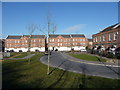
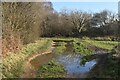
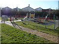
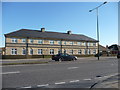
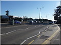
30 photos from this area
Area Information
Key information about the BH11 8TF including its size, population, and administrative classification.
- Area Type
- Postcode
- Area Size
- 5291 m²
- Population
- 1864
- Population Density
- 1249 people/km²
House Prices in BH11 8TF
13
Properties
£200,136
Average Sold Price
£82,000
Lowest Price
£300,000
Highest Price
Showing 13 properties
| Address | Type | Beds | Baths | Last Sale Price | Last Sale Date | |
|---|---|---|---|---|---|---|
| 17 Autumn Road, Poole, BH11 8TF | Terraced | - | - | £300,000 | Sep 2017 | |
| 11 Autumn Road, Poole, BH11 8TF | Terraced | 3 | 3 | £263,000 | Jun 2016 | |
| 6 Autumn Road, Poole, BH11 8TF | Terraced | 3 | 2 | £205,000 | Jan 2014 | |
| 8 Autumn Road, Poole, BH11 8TF | house | 3 | - | £195,000 | May 2012 | |
| 4 Autumn Road, Poole, BH11 8TF | Terraced | - | - | £225,500 | Jun 2008 | |
| 9 Autumn Road, Poole, BH11 8TF | house | - | - | £208,500 | Apr 2008 | |
| 2 Autumn Road, Poole, BH11 8TF | house | - | - | £185,000 | Sep 2007 | |
| 1 Autumn Road, Poole, BH11 8TF | house | - | - | £188,000 | May 2006 | |
| 15 Autumn Road, Poole, BH11 8TF | Semi-detached | 3 | 2 | £196,000 | Nov 2005 | |
| 5 Autumn Road, Poole, BH11 8TF | house | - | - | £153,500 | Dec 2003 |
Page 1 of 2
Energy Efficiency in BH11 8TF
Amenities
Schools
| Rank | School | Type | Entry gender | Ages |
|---|
Explore more schools in this area
Go to Schools tabDemographics
Household Size
Two person
most common
Accommodation Type
Houses
most common
Tenure
68
majority
Ethnic Group
White
most common
Religion
N/A
most common
Household Composition
N/A
most common
Age
47
median
Adults (30-64 years)
most common
Household Deprivation
N/A
with no deprivation
NS-SEC
36
in Lower managerial occupations
Explore more demographic insights in this area
Go to Demographics tabPlanning
Planning Constraints
- Flood RiskPremium
- Ramsar Wetland SitesPremium
- Area of Outstanding Natural BeautyPremium
- Protected Nature ReservePremium
- Protected WoodlandPremium