Area Overview for BH11 0GG
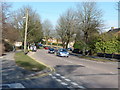
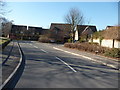
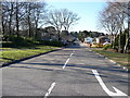
Photos of BH11 0GG


Area Information
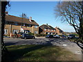
BH11 0GG is a small residential postcode area in England, encompassing a compact cluster of homes in the Kinson Ward of Bournemouth. With a population of around 1,525, it reflects a quiet, established community centred on local amenities and historical roots. The area lies along the main road connecting Wimborne and Bournemouth, a location that historically marked Kinson as a distinct village before its incorporation into Bournemouth in 1931. Today, its character is shaped by a mix of residential properties and proximity to retail, transport, and natural spaces. The median age of 47 suggests a mature demographic, with many residents in their 30s to 60s. Daily life here balances local convenience with access to broader regional infrastructure, from nearby rail links to coastal ferry services. The area’s small size means it is tightly integrated with surrounding districts, offering a sense of community without sacrificing connectivity. For buyers, BH11 0GG presents a blend of traditional housing and practical modern amenities, ideal for those seeking a settled lifestyle near essential services.
- Area Type
- Postcode
- Area Size
- Not available
- Population
- Not available
- Population Density
- Not available
BH11 0GG is characterised by a housing stock that leans heavily on individual homes, with 40% of properties owned by residents. This suggests a mix of owner-occupied and rental properties, though the relatively low home ownership rate implies a significant portion of the market is available for rent. The predominance of houses over flats or apartments reflects a suburban or semi-rural setting, suitable for families or those seeking space. Given the small size of the postcode area, the property market is likely limited in scale, with limited scope for large-scale development. Buyers should consider that the area’s compact nature may mean competition for available homes, particularly for those seeking established properties. The focus on houses also means that the market may cater more to buyers prioritising private outdoor space over high-density living. For investors, the rental market could offer opportunities, though the area’s stability may mean slower turnover compared to more dynamic regions.
House Prices in BH11 0GG
No properties found in this postcode.
Energy Efficiency in BH11 0GG
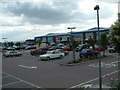
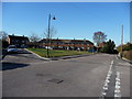
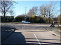
Living in BH11 0GG offers access to a range of amenities within practical reach. Retail options include Farmfoods Bournemouth, Lidl Bear, and Morrisons Daily, providing everyday shopping needs. The area’s rail network, with stations such as Branksome and Bournemouth, connects residents to broader transport systems. Nearby airports and ferry terminals enhance mobility, particularly for those reliant on air or sea travel. Public spaces like Turbary Common, established during the 1805 enclosure, offer green space for recreation. While the data does not mention parks or leisure facilities directly, the proximity to Poole’s ferry services suggests opportunities for coastal activities. The presence of multiple retail outlets and transport hubs indicates a lifestyle that balances convenience with access to regional amenities. For residents, the area’s compact size ensures that essential services are within walking or short driving distance, supporting a low-stress daily routine.
Amenities
Schools
Residents of BH11 0GG have access to three primary schools: Heathlands Junior School, Heathlands Primary School, and Heathlands Primary Academy. The latter holds a ‘good’ Ofsted rating, indicating a strong educational offering for younger children. The concentration of primary schools suggests the area is well-suited for families with young children, though no secondary schools are listed in the data. The presence of multiple primary schools may reduce travel times for parents, though the absence of secondary options could require commuting to nearby districts. For families, this mix of schools provides choices in early education, though further research would be needed to assess the quality of secondary schooling in the broader region. The proximity of these schools to homes in BH11 0GG reinforces the area’s appeal to households with children.
| Rank | School | Type | Entry gender | Ages |
|---|
Explore more schools in this area
Go to Schools tabDemographics
The population of BH11 0GG has a median age of 47, with the majority of residents aged between 30 and 64. This suggests a community of middle-aged individuals, likely with established careers and family ties. Home ownership stands at 40%, indicating that a significant portion of properties are rented rather than owned. The accommodation type is predominantly houses, which aligns with the area’s residential character. The predominant ethnic group is White, reflecting the broader demographic trends of the region. While no specific data on deprivation is provided, the age profile and home ownership rate suggest a stable, middle-income demographic. The absence of detailed diversity metrics means the community’s composition remains largely homogenous. For prospective buyers, this profile indicates a mature, low-turnover area with a focus on long-term residency. The lack of younger families or high-density housing may appeal to those prioritising quiet, established living over rapidly evolving neighbourhoods.
Household Size
Accommodation Type
Tenure
Ethnic Group
Religion
Household Composition
Age
Household Deprivation
NS-SEC
Explore more demographic insights in this area
Go to Demographics tabPlanning
Planning Constraints
- Flood RiskPremium
- Ramsar Wetland SitesPremium
- Area of Outstanding Natural BeautyPremium
- Protected Nature ReservePremium
- Protected WoodlandPremium