Area Overview for BH10 6YB
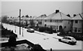
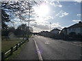
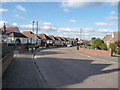
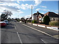
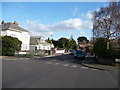
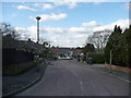
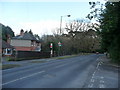
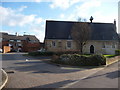
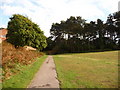
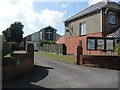
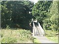
Photos of BH10 6YB
Area Information
BH10 6YB is a small residential postcode area nestled in the northern part of Bournemouth, Dorset. It forms part of the Redhill and Northbourne electoral ward, encompassing suburbs like Redhill, Northbourne, and parts of Ensbury Park and East Howe. With a population of approximately 1,587, it is a compact community characterised by a mix of suburban tranquillity and easy access to nearby amenities. The area has been represented by two councillors since 2019, reflecting its integration into the Bournemouth, Christchurch and Poole unitary authority. Life here is shaped by its proximity to Bournemouth’s urban core, offering a balance between residential comfort and connectivity. The postcode’s small size means it is tightly bound to local landmarks, from historic streets to modern infrastructure. Residents benefit from a well-defined neighbourhood feel, with a focus on family-oriented living and proximity to transport links. The area’s layout and low population density suggest a quiet, community-driven environment, ideal for those seeking a stable, manageable lifestyle without the pressures of larger cities.
- Area Type
- Postcode
- Area Size
- Not available
- Population
- 1587
- Population Density
- 1871 people/km²
The property market in BH10 6YB is dominated by owner-occupied homes, with 83% of properties in private hands. This high rate of home ownership indicates a stable, long-term resident base and a lower reliance on rental properties. The accommodation type is primarily houses, which is typical of suburban areas and suggests a focus on family homes rather than apartments or flats. This housing stock appeals to buyers seeking traditional, spacious living arrangements with a sense of permanence. The small size of the postcode area means that property availability is limited, making it a niche market for those prioritising specific locations within Bournemouth’s northern suburbs. Buyers should consider the surrounding areas for broader options, though BH10 6YB itself offers a compact, well-defined residential environment. The absence of rental-focused developments reinforces its appeal to owner-occupiers looking for a secure, low-maintenance investment.
House Prices in BH10 6YB
No properties found in this postcode.
Energy Efficiency in BH10 6YB
Living in BH10 6YB offers a blend of everyday convenience and regional connectivity. The area is served by five retail outlets, including Tesco Northbourne and Co-op Moordown, providing essential shopping and grocery needs. Nearby rail stations like Bournemouth Railway Station and Pokesdown Railway Station make commuting to the city centre or beyond straightforward. For those seeking leisure, five ferry landings, such as Wick Christchurch Ferry Landing, offer access to coastal and inland waterways, enhancing recreational opportunities. The proximity to Bournemouth Airport and Bournemouth International Airport ensures easy travel for business or holiday trips. The area’s mix of retail, transport, and scenic routes creates a lifestyle that balances practicality with access to broader regional amenities, supporting both daily routines and occasional escapes.
Amenities
Schools
| Rank | School | Type | Entry gender | Ages |
|---|
Explore more schools in this area
Go to Schools tabDemographics
The demographic profile of BH10 6YB reflects a mature, established community. The median age is 47, with the most common age range being adults aged 30–64, indicating a population skewed towards middle-aged residents. Home ownership is high at 83%, suggesting a strong presence of long-term residents and a stable housing market. The predominant accommodation type is houses, aligning with the area’s suburban character. The predominant ethnic group is White, though no specific diversity statistics are provided. The absence of detailed data on deprivation or socioeconomic distribution means the area’s quality of life is inferred from its safety and infrastructure. The low crime risk score of 87, combined with no significant environmental constraints, suggests a relatively secure and low-stress environment for residents. This demographic structure supports a community focused on stability, with a clear majority of owner-occupied homes and a mature population profile.
Household Size
Accommodation Type
Tenure
Ethnic Group
Religion
Household Composition
Age
Household Deprivation
NS-SEC
Explore more demographic insights in this area
Go to Demographics tabPlanning
Planning Constraints
- Flood RiskPremium
- Ramsar Wetland SitesPremium
- Area of Outstanding Natural BeautyPremium
- Protected Nature ReservePremium
- Protected WoodlandPremium