Area Overview for BH10 4YY
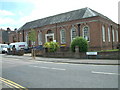
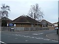
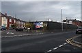
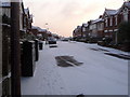
Photos of BH10 4YY


Area Information
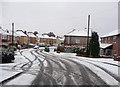
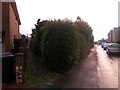
BH10 4YY is a small, residential postcode area in Bournemouth, part of the Moordown ward within the Bournemouth, Christchurch, and Poole Council. With a population of 1,908, it is a compact community nestled north of central Bournemouth, bordered by Winton to the south and Charminster to the east. The area has a rich history, including Bronze Age settlements and 19th-century developments like the Mayfield Park Estate. Daily life here is shaped by its suburban character, with a mix of historic landmarks such as St John’s Church and modern amenities. The area is well-connected, with nearby rail stations and ferry landings offering easy access to Bournemouth’s town centre and beyond. Residents benefit from a low crime score of 68, excellent broadband connectivity, and proximity to primary schools. The community, predominantly adults aged 30–64, reflects a settled demographic with a strong focus on family-oriented living.
- Area Type
- Postcode
- Area Size
- Not available
- Population
- Not available
- Population Density
- Not available
The property market in BH10 4YY is characterised by a 49% home ownership rate, indicating a balanced mix of owner-occupied and rental properties. Houses dominate the accommodation type, reflecting a preference for single-family homes in this small, residential cluster. Given the area’s limited size, the housing stock is modest, with limited scope for expansion. Buyers should consider the proximity to amenities like Winton County First School and transport links, which enhance the area’s appeal. The predominance of houses suggests a focus on long-term residency rather than short-term investment. However, the smaller market size may mean fewer options for buyers, requiring careful consideration of local planning constraints and proximity to key services.
House Prices in BH10 4YY
No properties found in this postcode.
Energy Efficiency in BH10 4YY
BH10 4YY offers a range of amenities within practical reach, including retail hubs like Tesco Moordown, Sainsburys Winton, and Iceland Winton, ensuring daily shopping needs are met. The area’s transport links extend to ferry landings and airports, facilitating travel to nearby towns and coastal destinations. Historic sites such as St John’s Church and the Mayfield Park Estate add character to the local landscape. The mix of shops, transport, and green spaces supports a lifestyle that balances convenience with suburban tranquillity. Residents benefit from easy access to Bournemouth’s amenities while retaining the charm of a smaller, community-focused environment.
Amenities
Schools
The nearest school to BH10 4YY is Winton County First School, a primary institution serving the local community. While no Ofsted rating is provided, its presence supports families seeking quality education for younger children. The absence of secondary schools in the immediate vicinity means residents may need to travel to nearby areas for higher education. This mix of primary and secondary schooling options, though limited, reflects the area’s role as part of a broader network of educational facilities in Bournemouth. Families should consider the need for additional transport or proximity to secondary schools when planning long-term living arrangements.
| Rank | School | Type | Entry gender | Ages |
|---|
Explore more schools in this area
Go to Schools tabDemographics
The population of BH10 4YY is 1,908, with a median age of 47, indicating a mature community. The most common age range is adults aged 30–64, suggesting a stable, family-oriented demographic. Home ownership stands at 49%, slightly below the national average, with houses being the predominant accommodation type. The predominant ethnic group is White, reflecting the area’s historical and cultural continuity. This profile points to a community that values established living environments over transient rental markets. The absence of specific data on deprivation means quality of life is inferred through factors like safety, connectivity, and amenities. The low crime score of 68 further supports a sense of security, aligning with the area’s suburban tranquillity.
Household Size
Accommodation Type
Tenure
Ethnic Group
Religion
Household Composition
Age
Household Deprivation
NS-SEC
Explore more demographic insights in this area
Go to Demographics tabPlanning
Planning Constraints
- Flood RiskPremium
- Ramsar Wetland SitesPremium
- Area of Outstanding Natural BeautyPremium
- Protected Nature ReservePremium
- Protected WoodlandPremium