Area Overview for BH10 4ES
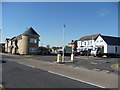
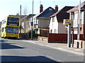
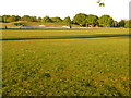
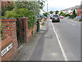
Photos of BH10 4ES
Area Information
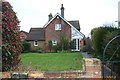
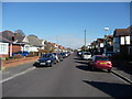
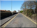
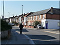
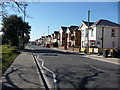
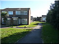
BH10 4ES is a compact residential postcode in Bournemouth, Dorset, covering 4,271 square metres and home to 1,505 residents. Its high population density of 352,338 people per square kilometre reflects a tightly knit community, shaped by historical land enclosures from the 1800s. Nestled north of central Bournemouth, the area’s boundaries follow ancient routes like Wallisdown Road, a medieval track that once linked Poole. Daily life here is defined by proximity to Bournemouth’s urban core, with easy access to transport networks and local amenities. The area’s small size means residents share a strong sense of place, with a mix of older homes and community spaces. While not a bustling commercial hub, it offers a quiet, residential atmosphere with a focus on local connectivity. For homebuyers, BH10 4ES represents a blend of historical character and modern convenience, ideal for those seeking a manageable, well-served suburb within a larger city framework.
- Area Type
- Postcode
- Area Size
- 4271 m²
- Population
- Not available
- Population Density
- Not available
BH10 4ES is primarily a house-owning area, with 51% of residents in owner-occupied properties. The prevalence of houses over flats suggests a suburban character, with properties likely offering more space and garden areas. Given the small size of the postcode, the housing stock is limited, making it a niche market for buyers seeking specific locations. The area’s proximity to Bournemouth’s transport networks and amenities may attract investors or first-time buyers looking for a quieter alternative to the city centre. However, the low population density and compact size mean competition for available homes could be fierce. For those considering the area, the focus on owner-occupation indicates a long-term commitment to the locality, with potential for property value stability. Buyers should note that the market is not rental-dominated, which may appeal to those prioritising equity growth over short-term flexibility.
House Prices in BH10 4ES
No properties found in this postcode.
Energy Efficiency in BH10 4ES
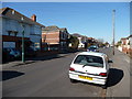
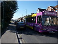
Living in BH10 4ES offers a range of nearby amenities, including five retail outlets such as Co-op Columbia, Aldi Wallisdown, and The Southern Co-operative Co, ensuring everyday shopping needs are met. The area’s proximity to rail stations like Branksome and Bournemouth provides easy access to urban centres, while two airports cater to regional travel. Ferries to Poole Quay and Brownsea Island offer recreational opportunities, from sightseeing to island visits. The mix of retail, transport, and leisure options supports a convenient lifestyle, with minimal need for long commutes. The presence of multiple rail stations also facilitates connections to other parts of the South West. While the area lacks large supermarkets or entertainment hubs, its compact size ensures that essential services are within practical reach, fostering a self-contained yet connected community.
Amenities
Schools
Two primary schools serve BH10 4ES: St Mark’s Church of England Aided Primary School and St Mark’s Church of England Primary School. Both are faith-based institutions, offering education for younger children. The second school holds an Ofsted rating of “good,” reflecting its quality of teaching and student outcomes. The presence of two primary schools within the area provides families with options, though neither offers secondary education. This means students will need to travel to nearby schools in Bournemouth for secondary schooling. The schools’ proximity to residential areas ensures ease of access for parents, and their church-affiliated status may appeal to families seeking a particular educational ethos. For homebuyers prioritising schools, the availability of primary education is a key consideration, though secondary schooling will require additional planning.
| Rank | School | Type | Entry gender | Ages |
|---|
Explore more schools in this area
Go to Schools tabDemographics
The population of BH10 4ES is predominantly adults aged 30–64, with a median age of 47. This suggests a mature, stable community with a focus on established households rather than young families. Home ownership stands at 51%, slightly below the national average, indicating a mix of owner-occupied and rented properties. The area is characterised by houses rather than flats, reflecting a traditional suburban layout. The predominant ethnic group is White, with no specific data provided on other demographics. The age profile implies a population that may prioritise low-maintenance living, with fewer children in schools compared to younger areas. The high proportion of middle-aged residents could influence local services and amenities, such as healthcare and leisure facilities. This demographic profile aligns with a community that values stability and proximity to urban services without the pressures of a high-density city.
Household Size
Accommodation Type
Tenure
Ethnic Group
Religion
Household Composition
Age
Household Deprivation
NS-SEC
Explore more demographic insights in this area
Go to Demographics tabPlanning
Planning Constraints
- Flood RiskPremium
- Ramsar Wetland SitesPremium
- Area of Outstanding Natural BeautyPremium
- Protected Nature ReservePremium
- Protected WoodlandPremium