Area Overview for BH10 4DL
Photos of BH10 4DL
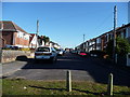
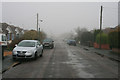
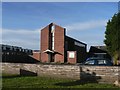
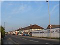
100 photos from this area
Area Information
Key information about the BH10 4DL including its size, population, and administrative classification.
- Area Type
- Postcode
- Area Size
- 1.2 hectares
- Population
- 1728
- Population Density
- 3985 people/km²
House Prices in BH10 4DL
27
Properties
£249,100
Average Sold Price
£55,000
Lowest Price
£490,000
Highest Price
Showing 27 properties
| Address | Type | Beds | Baths | Last Sale Price | Last Sale Date | |
|---|---|---|---|---|---|---|
| 14 Kingsbere Avenue, Bournemouth, BH10 4DL | Detached | 4 | 1 | £490,000 | Jul 2025 | |
| 29 Kingsbere Avenue, Bournemouth, BH10 4DL | Bungalow | 2 | - | £265,000 | Nov 2024 | |
| 3 Kingsbere Avenue, Bournemouth, BH10 4DL | Bungalow | 2 | 1 | £278,000 | Oct 2024 | |
| 18 Kingsbere Avenue, Bournemouth, BH10 4DL | Bungalow | - | - | £410,000 | Apr 2024 | |
| 8 Kingsbere Avenue, Bournemouth, BH10 4DL | Bungalow | - | - | £375,000 | Dec 2021 | |
| 9 Kingsbere Avenue, Bournemouth, BH10 4DL | Bungalow | - | - | £420,000 | Nov 2021 | |
| 6 Kingsbere Avenue, Bournemouth, BH10 4DL | Bungalow | - | - | £362,500 | Sep 2021 | |
| 27 Kingsbere Avenue, Bournemouth, BH10 4DL | Bungalow | - | - | £263,800 | Oct 2018 | |
| 19 Kingsbere Avenue, Bournemouth, BH10 4DL | Bungalow | 2 | 1 | £185,750 | Oct 2013 | |
| 20 Kingsbere Avenue, Bournemouth, BH10 4DL | Detached | - | - | £240,000 | Oct 2008 |
Page 1 of 3
Energy Efficiency in BH10 4DL
Amenities
Schools
| Rank | School | Type | Entry gender | Ages |
|---|
Explore more schools in this area
Go to Schools tabDemographics
Household Size
Two person
most common
Accommodation Type
Houses
most common
Tenure
73
majority
Ethnic Group
White
most common
Religion
N/A
most common
Household Composition
N/A
most common
Age
47
median
Adults (30-64 years)
most common
Household Deprivation
N/A
with no deprivation
NS-SEC
27
in Lower managerial occupations
Explore more demographic insights in this area
Go to Demographics tabPlanning
Planning Constraints
- Flood RiskPremium
- Ramsar Wetland SitesPremium
- Area of Outstanding Natural BeautyPremium
- Protected Nature ReservePremium
- Protected WoodlandPremium