Area Overview for BH1 4PA
Photos of BH1 4PA
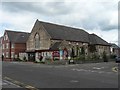
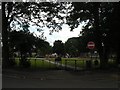
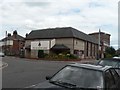
100 photos from this area
Area Information
Key information about the BH1 4PA including its size, population, and administrative classification.
- Area Type
- Postcode
- Area Size
- 5878 m²
- Population
- 1609
- Population Density
- 11651 people/km²
House Prices in BH1 4PA
37
Properties
£147,783
Average Sold Price
£19,000
Lowest Price
£275,000
Highest Price
Showing 37 properties
| Address | Type | Beds | Baths | Last Sale Price | Last Sale Date | |
|---|---|---|---|---|---|---|
| 2C South Road, Bournemouth, BH1 4PA | Flat | 1 | 1 | £140,000 | Apr 2025 | |
| 24 South Road, Bournemouth, BH1 4PA | Terraced | 2 | 1 | £267,000 | Aug 2024 | |
| 26 South Road, Bournemouth, BH1 4PA | Terraced | 2 | 1 | £275,000 | Jul 2024 | |
| 44 South Road, Bournemouth, BH1 4PA | Terraced | 2 | 1 | £240,000 | Feb 2024 | |
| 46 South Road, Bournemouth, BH1 4PA | house | 2 | 1 | £261,200 | Jan 2024 | |
| 48 South Road, Bournemouth, BH1 4PA | Terraced | 2 | - | £187,000 | Jul 2019 | |
| 36 South Road, Bournemouth, BH1 4PA | Terraced | 2 | 1 | £224,000 | Mar 2019 | |
| 10 South Road, Bournemouth, BH1 4PA | Terraced | 2 | 1 | £193,750 | Dec 2016 | |
| 14 South Road, Bournemouth, BH1 4PA | Terraced | 3 | 1 | £195,000 | Mar 2016 | |
| 40 South Road, Bournemouth, BH1 4PA | Terraced | 2 | 1 | £167,000 | May 2014 |
Page 1 of 4
Energy Efficiency in BH1 4PA
Amenities
Schools
| Rank | School | Type | Entry gender | Ages |
|---|
Explore more schools in this area
Go to Schools tabDemographics
Household Size
Family (3-5 people)
most common
Accommodation Type
Houses
most common
Tenure
49
majority
Ethnic Group
White
most common
Religion
N/A
most common
Household Composition
N/A
most common
Age
47
median
Adults (30-64 years)
most common
Household Deprivation
N/A
with no deprivation
NS-SEC
26
in Lower managerial occupations
Explore more demographic insights in this area
Go to Demographics tabPlanning
Planning Constraints
- Flood RiskPremium
- Ramsar Wetland SitesPremium
- Area of Outstanding Natural BeautyPremium
- Protected Nature ReservePremium
- Protected WoodlandPremium