Area Overview for BH1 4AT
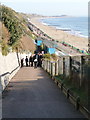
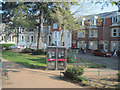
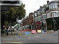
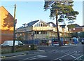
Photos of BH1 4AT


Area Information
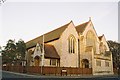
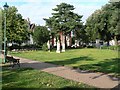
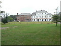
BH1 4AT lies in the heart of Boscombe, a historic seaside suburb east of central Bournemouth. With a population of 2,142, it is a compact residential cluster characterised by a mix of Victorian, Edwardian, and modernist architecture. Originally a separate village, Boscombe was incorporated into Bournemouth in 1876, though locals resisted the merger. Today, the area thrives as a blend of coastal charm and practical living, with amenities like Sainsburys Boscombe and Christchurch Quay Ferry Landing within easy reach. Its proximity to Bournemouth International Airport and multiple railway stations, including Pokesdown and Bournemouth, ensures strong connectivity. The area’s appeal lies in its balance of seaside access, historical landmarks such as Boscombe Pier and San Remo Towers, and a mature community with a median age of 47. Living here offers a quiet, established environment with a focus on local traditions and coastal lifestyle.
- Area Type
- Postcode
- Area Size
- Not available
- Population
- Not available
- Population Density
- Not available
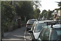
BH1 4AT is a small area with a housing stock dominated by flats, reflecting its compact residential nature. With only 31% of homes owner-occupied, the market is largely rental-based, making it an attractive option for investors seeking steady returns. The prevalence of flats suggests limited availability of larger family homes, which may be more common in surrounding areas. Buyers should consider the area’s size and the dominance of flats when evaluating long-term value. While the low home ownership rate indicates a transient population, the area’s proximity to Bournemouth’s amenities and transport links could offset this. For those seeking a quiet, established environment with coastal access, BH1 4AT offers a niche opportunity, though property choices are constrained by its small footprint.
House Prices in BH1 4AT
No properties found in this postcode.
Energy Efficiency in BH1 4AT
Residents of BH1 4AT have access to a range of amenities within practical reach. Retail options include Sainsburys Boscombe, Lidl Boscombe, and Aldi Boscombe, catering to daily needs. The area’s proximity to Christchurch Quay Ferry Landing and Tuckton Tea Gardens Ferry Landing provides easy access to coastal leisure activities. Rail stations like Pokesdown and Bournemouth connect to broader networks, while Bournemouth International Airport is nearby. Local landmarks such as Boscombe Pier, Boscombe Chine Gardens, and San Remo Towers add character to daily life. The mix of retail, transport, and natural attractions creates a convenient, well-rounded lifestyle, blending seaside charm with practical living.
Amenities
Schools
| Rank | School | Type | Entry gender | Ages |
|---|
Explore more schools in this area
Go to Schools tabDemographics
The population of BH1 4AT is 2,142, with a median age of 47, indicating a mature demographic. The most common age range is 30–64 years, reflecting a community of middle-aged adults. Home ownership rates are low at 31%, suggesting a predominance of rental properties. Accommodation is primarily flats, a key feature of the area’s housing stock. The predominant ethnic group is White, with no data provided on other demographics. This profile implies a stable, long-term resident base, though the low home ownership percentage may indicate a reliance on rental markets. The age distribution suggests a community focused on established living rather than young families, which could influence local amenities and services.
Household Size
Accommodation Type
Tenure
Ethnic Group
Religion
Household Composition
Age
Household Deprivation
NS-SEC
Explore more demographic insights in this area
Go to Demographics tabPlanning
Planning Constraints
- Flood RiskPremium
- Ramsar Wetland SitesPremium
- Area of Outstanding Natural BeautyPremium
- Protected Nature ReservePremium
- Protected WoodlandPremium