Area Overview for BH1 3HU
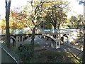
Photos of BH1 3HU


Area Information
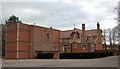
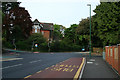
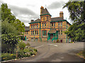
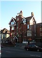
Living in BH1 3HU means inhabiting a small, defined postcode area in Bournemouth, England, where residential clusters are tightly woven into the local landscape. With a population of 1,893, this area is compact yet rich in historical and architectural character. Situated in the East Cliff and Springbourne electoral ward, it sits within Bournemouth’s main built-up area, blending Victorian and Edwardian influences. The suburb of Springbourne, for instance, retains its 19th-century roots, with cottages and avenues named after US presidents. Daily life here is shaped by proximity to retail, transport, and leisure hubs. Residents benefit from nearby rail stations, ferry landings, and two airports, ensuring connectivity to broader regional networks. The area’s appeal lies in its manageable size, historical charm, and practical amenities, making it a viable choice for those seeking a balance between tradition and modern convenience.
- Area Type
- Postcode
- Area Size
- Not available
- Population
- 1893
- Population Density
- 3101 people/km²
BH1 3HU’s property market is defined by its high proportion of flats, which dominate the housing stock. With 52% of homes owner-occupied, the area is not heavily reliant on rentals, though the exact rental market dynamics are unspecified. Flats in this postcode are likely to be part of purpose-built residential schemes or converted properties, typical of smaller urban clusters. The limited population size (1,893) and compact nature of the area suggest a constrained housing supply, which could influence property values and availability. Buyers should consider that flats in this area may cater to both long-term residents and those seeking proximity to Bournemouth’s amenities. The lack of larger detached homes implies a focus on shared spaces and community living, which may appeal to those prioritising convenience over expansive private land.
House Prices in BH1 3HU
Showing 2 properties
| Address | Type | Beds | Baths | Last Sale Price | Last Sale Date | |
|---|---|---|---|---|---|---|
| Acacia Garden, 12 Manor Road, Bournemouth, BH1 3HU | Detached | 1 | - | £900,000 | Aug 2019 | |
| The Cottage, Acacia Garden, 12 Manor Road, Bournemouth, BH1 3HU | Cottage | 7 | - | - | - |
Energy Efficiency in BH1 3HU
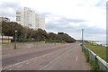
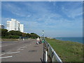
The lifestyle in BH1 3HU is shaped by its proximity to retail, transport, and leisure hubs. Within practical reach are five retail outlets, including Co-op Bournemouth, Tesco, and Asda, offering everyday shopping convenience. Rail stations like Bournemouth and Branksome provide direct links to cities such as Southampton and London, while ferry landings at Tuckton and Christchurch Quay connect to nearby coastal towns. Bournemouth International Airport is a short distance away, catering to travel needs. The area’s historical character, including Victorian cottages and Edwardian avenues, adds a distinct aesthetic to daily life. Residents can enjoy the Cricketers Arms pub, dating to 1867, and the Carnegie-funded Springbourne Library, blending heritage with modern amenities. This mix of practicality and tradition supports a lifestyle that balances convenience with local identity.
Amenities
Schools
| Rank | School | Type | Entry gender | Ages |
|---|
Explore more schools in this area
Go to Schools tabDemographics
The population of BH1 3HU skews towards adults aged 30–64, with a median age of 47. This suggests a community of established professionals and families, rather than students or retirees. Home ownership here is at 52%, indicating a mix of owner-occupied and rental properties. The predominant accommodation type is flats, which aligns with the area’s compact residential layout. The majority of residents identify as White, reflecting the broader demographic trends in the region. While no specific data on deprivation or diversity is provided, the age profile and housing stock suggest a stable, middle-aged population with a focus on practical living. The absence of detailed diversity metrics means the community’s social composition remains largely unexplored in this data set.
Household Size
Accommodation Type
Tenure
Ethnic Group
Religion
Household Composition
Age
Household Deprivation
NS-SEC
Explore more demographic insights in this area
Go to Demographics tabPlanning
Planning Constraints
- Flood RiskPremium
- Ramsar Wetland SitesPremium
- Area of Outstanding Natural BeautyPremium
- Protected Nature ReservePremium
- Protected WoodlandPremium