Area Overview for BH1 3DS
Photos of BH1 3DS


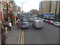
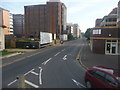
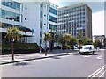
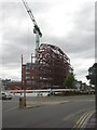
100 photos from this area
Area Information
Key information about the BH1 3DS including its size, population, and administrative classification.
- Area Type
- Postcode
- Area Size
- Not available
- Population
- Not available
- Population Density
- Not available
House Prices in BH1 3DS
24
Properties
£203,028
Average Sold Price
£62,000
Lowest Price
£277,500
Highest Price
Showing 24 properties
| Address | Type | Beds | Baths | Last Sale Price | Last Sale Date | |
|---|---|---|---|---|---|---|
| E7, Elizabeth Court, Grove Road, Bournemouth, BH1 3DS | Flat | - | - | £265,000 | Jul 2017 | |
| E3, Elizabeth Court, Grove Road, Bournemouth, BH1 3DS | Flat | 2 | 1 | £200,000 | Jul 2016 | |
| F4, Elizabeth Court, Grove Road, Bournemouth, BH1 3DS | Flat | - | - | £277,500 | Mar 2016 | |
| G3, Elizabeth Court, Grove Road, Bournemouth, BH1 3DS | Flat | 2 | 1 | £195,000 | Feb 2016 | |
| G4, Elizabeth Court, Grove Road, Bournemouth, BH1 3DS | Flat | - | - | £267,500 | Nov 2015 | |
| E4, Elizabeth Court, Grove Road, Bournemouth, BH1 3DS | Flat | - | - | £108,284 | Aug 2015 | |
| G1, Elizabeth Court, Grove Road, Bournemouth, BH1 3DS | Flat | 2 | 1 | £250,000 | Oct 2014 | |
| F1, Elizabeth Court, Grove Road, Bournemouth, BH1 3DS | Flat | 2 | 1 | £180,000 | Oct 2014 | |
| G2, Elizabeth Court, Grove Road, Bournemouth, BH1 3DS | Flat | - | - | £225,000 | Jul 2012 | |
| E5, Elizabeth Court, Grove Road, Bournemouth, BH1 3DS | Flat | - | - | £62,000 | Jan 1996 |
Page 1 of 3
Energy Efficiency in BH1 3DS
Amenities
Schools
| Rank | School | Type | Entry gender | Ages |
|---|
Explore more schools in this area
Go to Schools tabDemographics
Household Size
One person
most common
Accommodation Type
Flats
most common
Tenure
34
majority
Ethnic Group
White
most common
Religion
N/A
most common
Household Composition
N/A
most common
Age
22
median
Young Adults (15-29 years)
most common
Household Deprivation
N/A
with no deprivation
NS-SEC
21
in Lower managerial occupations
Explore more demographic insights in this area
Go to Demographics tabPlanning
Planning Constraints
- Flood RiskPremium
- Ramsar Wetland SitesPremium
- Area of Outstanding Natural BeautyPremium
- Protected Nature ReservePremium
- Protected WoodlandPremium