Area Overview for BH1 3DL
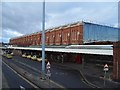
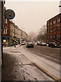
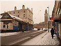
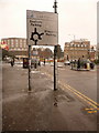
Photos of BH1 3DL


Area Information
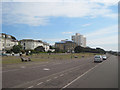
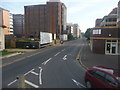
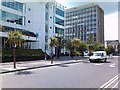
Living in BH1 3DL means inhabiting a compact, densely populated residential cluster in Bournemouth, England. The area spans just 1.0 hectare, housing 1,893 residents in a high-density arrangement of 184,539 people per square kilometre. This postcode falls within the East Cliff and Springbourne electoral ward, a historically significant suburb known for its Victorian and Edwardian architecture. Daily life here is shaped by proximity to retail hubs like Asda Bath and Tesco Bournemouth, alongside easy access to rail networks including Bournemouth Railway Station. The area’s compact size fosters a tight-knit community, though its small footprint means limited expansion. Residents benefit from nearby ferry landings and two airports, offering transport versatility. The area’s character blends practicality with heritage, from 19th-century cottages to 20th-century infrastructure, creating a distinct urban-rural hybrid environment. For those seeking a mix of convenience and historical context, BH1 3DL offers a focused, manageable living space.
- Area Type
- Postcode
- Area Size
- 1.0 hectares
- Population
- 1893
- Population Density
- 3101 people/km²
The property market in BH1 3DL is characterised by a high proportion of flats, reflecting the area’s small size and dense population. With 52% of homes owner-occupied, the market balances private ownership with rental availability. The compact nature of the postcode means housing stock is limited, and the immediate surroundings likely offer few alternative properties. This creates a scenario where buyers must consider proximity to amenities and transport links as critical factors. The prevalence of flats may appeal to those prioritising convenience over space, though the high density could limit options for larger families. Given the area’s proximity to Bournemouth’s main built-up zones, property values may be influenced by broader regional trends. Buyers should also note the lack of protected natural areas or planning constraints, which may allow for future development but could affect long-term property stability.
House Prices in BH1 3DL
Showing 2 properties
| Address | Type | Beds | Baths | Last Sale Price | Last Sale Date | |
|---|---|---|---|---|---|---|
| Managers Accomodation, Queens Hotel, Meyrick Road, Bournemouth, BH1 3DL | Flat | - | - | - | - | |
| Queens Hotel, Meyrick Road, Bournemouth, BH1 3DL | hotel | - | - | - | - |
Energy Efficiency in BH1 3DL
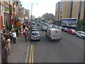
Living in BH1 3DL grants access to a range of retail and transport options within short distances. Nearby shops include Asda Bath, The Southern Co-operative Co, and Tesco Bournemouth, offering everyday essentials. Rail networks connect residents to Bournemouth, Pokesdown, and Branksome stations, facilitating easy travel to larger towns and cities. Ferry landings at Tuckton Tea Gardens and Christchurch Quay provide water-based transport links, though their use may depend on seasonal or recreational needs. The area’s proximity to Bournemouth International Airport ensures swift access to regional and international destinations. While the immediate vicinity lacks expansive parks or leisure facilities, the compact layout encourages walking and cycling. The presence of historical landmarks, such as the Cricketers Arms pub and Springbourne Library, adds cultural depth to daily life. This blend of practicality and heritage defines the lifestyle in BH1 3DL.
Amenities
Schools
| Rank | School | Type | Entry gender | Ages |
|---|
Explore more schools in this area
Go to Schools tabDemographics
The community in BH1 3DL is predominantly composed of adults aged 30–64, with a median age of 47. This suggests a mature population, likely with established careers and families. Home ownership rates stand at 52%, indicating a balanced mix of owner-occupied and rental properties. The accommodation type is primarily flats, reflecting the area’s high density and compact layout. The predominant ethnic group is White, though no specific diversity statistics are provided. The population density of 184,539 people per square kilometre implies a tightly packed residential environment, which may influence social dynamics and access to shared spaces. While the data does not quantify deprivation levels, the high density and limited area size could impact living conditions, particularly in terms of space and privacy. This demographic profile suggests a community focused on stability and proximity to essential services.
Household Size
Accommodation Type
Tenure
Ethnic Group
Religion
Household Composition
Age
Household Deprivation
NS-SEC
Explore more demographic insights in this area
Go to Demographics tabPlanning
Planning Constraints
- Flood RiskPremium
- Ramsar Wetland SitesPremium
- Area of Outstanding Natural BeautyPremium
- Protected Nature ReservePremium
- Protected WoodlandPremium