Area Overview for BH1 2LJ
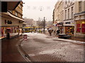
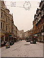
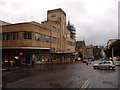
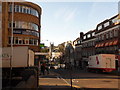
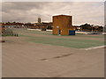
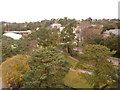
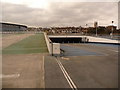
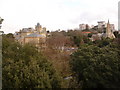
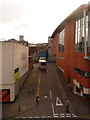
Photos of BH1 2LJ


Area Information
Living in BH1 2LJ means residing within the Bournemouth Central ward, a compact residential cluster of 1,575 people situated in the heart of Dorset. This postcode covers a small area close to the coast, positioned between West Cliff and East Cliff near Richmond Hill and Lansdowne. The neighbourhood forms part of Bournemouth's central business district, creating an urban environment distinct from quieter residential suburbs. You are located near significant historic landmarks, including the Royal Exeter Hotel, built in 1812, and the Bournemouth Town Hall from 1885. The area is defined by its density and city-centre convenience rather than expansive gardens or large plots. Daily life revolves around proximity to the town centre, with immediate access to major thoroughfares and commercial hubs. The ward was established in 2019 after previous administrative changes, ensuring your location falls within a modern electoral boundary. Whether you commute to the financial sector or work in local retail and hospitality, the centrality of BH1 2LJ provides quick access to the wider region. This specific postcode represents a slice of Bournemouth's active urban fabric where history meets daily commerce and transport links.
- Area Type
- Postcode
- Area Size
- Not available
- Population
- 1575
- Population Density
- 6336 people/km²
The property market in BH1 2LJ is overwhelmingly a rental sector. With only 16% of residents owning their homes, this postcode is primarily suited for tenants seeking flat accommodation. The accommodation type data confirms that flats dominate the housing stock in this small residential cluster. Buyers looking for detached houses or semi-detached homes in the immediate vicinity of BH1 2LJ will find limited options within this specific cluster, as the built environment focuses on residential blocks typical of a town centre location. The high density of rental properties implies a dynamic market driven by demand from workers in the local hospitality, retail, and finance industries. If you are considering purchasing a home in this immediate area, your search may need to extend slightly beyond the strict BH1 2LJ boundaries to find owner-occupied stock, though you would still be walking distance to the town's core amenities. The 87% rental rate signals a landlord-tenant ecosystem rather than a family homebuyer bubble. Prospective buyers must recognise that this is a centrepoint urban zone where tenancy is the norm and flats are the standard housing form.
House Prices in BH1 2LJ
No properties found in this postcode.
Energy Efficiency in BH1 2LJ
Your lifestyle as a resident of BH1 2LJ is defined by central convenience and diverse shopping choices. You have immediate access to five retail outlets within easy reach, including Tesco Bournemouth, Asda Bath, and The Southern Co-operative Co. These supermarkets provide all necessary daily groceries and household essentials without a car journey. Beyond retail, the ward offers excellent public transport connections with five nearby rail stations and five ferry landings, integrating you directly into the wider South West network. You can walk to the Pavilion Theatre and the Bournemouth International Centre to enjoy cultural events. While parks are not explicitly detailed in the amenity list, your location near Richmond Hill and within the town centre means green spaces are accessible. The area is characterised by a high concentration of amenities including five airports in the broader vicinity for business travel. Daily life involves walking distance access to major chains and leisure venues. You will find that the urban setting offers a self-contained experience where work, shop, and social activities are clustered together efficiently.
Amenities
Schools
Families looking for education options near BH1 2LJ have access to specific private institutions. The Bournemouth Jewish Day School is located nearby and operates as an independent school. This is the only school named in the data for your immediate vicinity. Because independent schools hold their own Ofsted ratings separate from the state sector, specific inspection grades are not included in the provided information for this location. The presence of a single independent school suggests that residents with children may travel further afield for state-maintained primary and secondary education, or rely on the provisions of the selected private institution. The mix of school types in the wider catchment includes both faith-based and community schools, but the direct proximity to BH1 2LJ is currently defined by this one independent provider. Parents should verify travel times and admission policies for the Bournemouth Jewish Day School, as it is the confirmed educational facility listed for the area.
| Rank | School | Type | Entry gender | Ages |
|---|
Explore more schools in this area
Go to Schools tabDemographics
The community in BH1 2LJ reflects an established urban population with a median age of 47 years. Most residents fall into the adults category between 30 and 64 years old, indicating a settled demographic rather than a transient student population. Home ownership stands at just 16%, meaning the vast majority of residents rent their properties. This high rental proportion aligns with the dominant accommodation type, which consists of flats. The predominant ethnic group is White, though the broader ward is noted for being the most diverse area within Bournemouth. Residents are frequently employed in wholesale and retail trade, as well as within hotels, catering, and financial insurance sectors. This employment profile explains the concentration of rental units suited for professionals and service workers. The age distribution suggests a stable community where families and long-term renters coexist. You can expect a neighbourhood where the typical householder is over forty and likely working in a professional capacity. The demographic data paints a picture of a mature rental market catering to working-age adults who value the convenience of city living over property ownership.
Household Size
Accommodation Type
Tenure
Ethnic Group
Religion
Household Composition
Age
Household Deprivation
NS-SEC
Explore more demographic insights in this area
Go to Demographics tabPlanning
Planning Constraints
- Flood RiskPremium
- Ramsar Wetland SitesPremium
- Area of Outstanding Natural BeautyPremium
- Protected Nature ReservePremium
- Protected WoodlandPremium