Area Overview for BH1 1NN
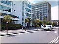
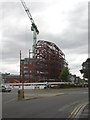
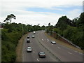
Photos of BH1 1NN

Area Information
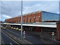
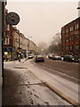
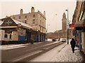
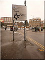
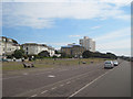
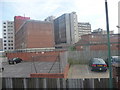
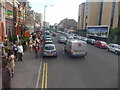
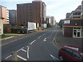
BH1 1NN lies at the heart of Bournemouth’s Central ward, a compact residential cluster within the bustling town centre. With a population of 2,443, this area blends urban convenience with coastal proximity, situated between West Cliff and East Cliff. The ward includes landmarks like the Royal Exeter Hotel, Bournemouth Town Hall, and the Pavilion Theatre, reflecting its historical and cultural significance. Daily life here is shaped by its role as Bournemouth’s central business district, offering a mix of retail, dining, and leisure. The area’s diversity is notable, with residents employed across sectors like hospitality, retail, and finance. Despite its small size, BH1 1NN is rich in heritage, from 19th-century architecture to modern infrastructure. Its proximity to the coast and transport hubs makes it a dynamic place for young professionals and families seeking accessibility and activity. However, the area’s character is defined by its urban density and the legacy of events like the 1908 tramway accident, which underscores its long-standing role as a focal point for the town.
- Area Type
- Postcode
- Area Size
- Not available
- Population
- Not available
- Population Density
- Not available
The property market in BH1 11N is characterised by a low home ownership rate of 26%, indicating that the majority of housing is rented rather than owned. Flats dominate the accommodation type, reflecting the area’s urban density and compact nature. This suggests a rental market driven by short-term tenancies, likely attracting students, young professionals, and those seeking proximity to Bournemouth’s amenities. The limited size of the area means housing stock is constrained, with few new developments likely to arise. For buyers, this presents challenges: the small footprint and rental focus may limit availability of owner-occupied properties. However, the area’s centrality and transport links could make it appealing for those prioritising location over long-term investment. Prospective buyers should consider the transient nature of the market and the potential for competition in securing property.
House Prices in BH1 1NN
No properties found in this postcode.
Energy Efficiency in BH1 1NN
Living in BH1 1NN offers access to a range of amenities within practical reach. Retail options include Asda Bath, Tesco Bournemouth, and The Southern Co-operative, catering to everyday needs. The area’s proximity to Bournemouth’s town centre and coastal locations means residents can enjoy dining, leisure, and cultural activities. Rail stations like Bournemouth Railway Station provide easy access to nearby towns, while ferry landings at Tuckton Tea Gardens and Christchurch Quay connect to scenic routes. The presence of Bournemouth International Airport adds to the area’s convenience. These amenities create a lifestyle that balances urban accessibility with coastal charm, though the density of the area may mean limited green spaces. The mix of retail, transport, and coastal proximity defines a practical, active daily life for residents.
Amenities
Schools
The nearest school to BH1 1NN is Livingstone Academy Bournemouth, an academy with a Good Ofsted rating. This school serves the local community, offering education to students in the area. The presence of a single academy suggests a focused educational offering, though the data does not specify its age ranges or specialisms. For families, this school provides a structured learning environment, though the absence of other schools in the immediate vicinity may necessitate travel for alternative options. The Good rating indicates a satisfactory standard of education, but parents should consider additional factors such as catchment areas and school capacity. Given the area’s youthful demographic, the academy likely plays a central role in supporting local families.
| Rank | School | Type | Entry gender | Ages |
|---|
Explore more schools in this area
Go to Schools tabDemographics
The population of BH1 1NN skews young, with a median age of 22 and the majority of residents aged 15–29. This reflects a community dominated by students, young professionals, and early-career individuals. Home ownership is low at 26%, indicating a rental-heavy market, with flats being the primary accommodation type. The predominant ethnic group is White, though the ward is noted as the most diverse in Bournemouth, suggesting a mix of backgrounds. This demographic profile shapes the area’s social fabric, with a focus on transient or semi-permanent residency. The high proportion of young adults influences local amenities and services, which cater to a mobile population. While the data does not specify deprivation levels, the low home ownership and youthful demographic may imply a reliance on rental income or student funding, impacting long-term stability for some residents.
Household Size
Accommodation Type
Tenure
Ethnic Group
Religion
Household Composition
Age
Household Deprivation
NS-SEC
Explore more demographic insights in this area
Go to Demographics tabPlanning
Planning Constraints
- Flood RiskPremium
- Ramsar Wetland SitesPremium
- Area of Outstanding Natural BeautyPremium
- Protected Nature ReservePremium
- Protected WoodlandPremium