Area Overview for BH1 1HZ
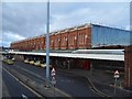
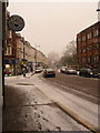
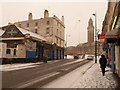
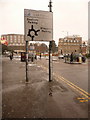
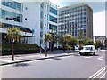
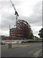
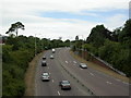
Photos of BH1 1HZ

Area Information
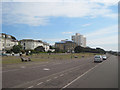
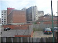
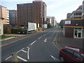
Living in BH1 1HZ means inhabiting a compact, densely populated postcode in Bournemouth’s central hub. This small residential cluster, spanning just 3,401 square metres, is part of Bournemouth Central electoral ward, a historically significant area marked by landmarks like the Royal Exeter Hotel and Bournemouth Town Hall. With a population of 2,014 people, the area is among the most ethnically diverse in Bournemouth, reflecting a mix of residents working in retail, hospitality, and financial sectors. Daily life here is shaped by proximity to the coast, with easy access to West Cliff and East Cliff. The area’s urban character is defined by its role as a business district, yet it retains a tight-knit community feel. Its history includes notable events like the 1908 tramway accident, underscoring its long-standing connection to Bournemouth’s development. For buyers, BH1 1HZ offers a blend of convenience and character, though its small size means housing options are limited to flats, with a strong emphasis on owner-occupation.
- Area Type
- Postcode
- Area Size
- 3401 m²
- Population
- Not available
- Population Density
- Not available
The property market in BH1 1HZ is characterised by a high proportion of flats, with home ownership at 54% and the remaining 46% occupied by renters. This suggests a mix of owner-occupied and rental properties, though the small area size means housing options are limited. Flats dominate, reflecting the urban nature of the postcode and its role as a central business district. Buyers should consider that the area’s compact size may lead to competition for available properties, particularly given the high population density. The focus on flats may appeal to those seeking convenience and proximity to amenities, but it also means limited scope for larger family homes. For those considering the area, the high home ownership rate indicates a stable market, though buyers should assess whether the housing stock aligns with their needs, particularly if they require more space or a different property type.
House Prices in BH1 1HZ
Showing 1 properties
| Address | Type | Beds | Baths | Last Sale Price | Last Sale Date | |
|---|---|---|---|---|---|---|
| Flat, 26 Dean Park Road, Bournemouth, BH1 1HZ | Detached | - | - | £400,000 | Jan 2023 |
Energy Efficiency in BH1 1HZ
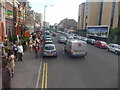
Life in BH1 1HZ is supported by a range of amenities within easy reach. Retail options include major chains like Asda Bournemouth, Tesco Bournemouth, and The Southern Co-operative Co, ensuring daily shopping needs are met. The area’s rail network connects to stations such as Pokesdown and Branksome, facilitating commuting to nearby areas. For travel beyond the region, Bournemouth Airport and Bournemouth International Airport provide direct flight access. Ferries to Christchurch and Tuckton Tea Gardens add to the area’s connectivity, offering scenic routes and transport links. The presence of multiple airports, rail stations, and ferry landings underscores BH1 1HZ’s role as a transport hub, enhancing convenience for both residents and visitors. These amenities contribute to a dynamic lifestyle, blending urban convenience with coastal accessibility.
Amenities
Schools
Residents of BH1 1HZ have access to two notable schools within practical reach. Bournemouth Christian School is an independent institution, while Kings Bournemouth is also independent and holds a ‘good’ Ofsted rating. The presence of independent schools suggests an appeal to families seeking alternative education options, though no state schools are listed in the data. This mix of school types may cater to diverse educational preferences, but it also means families should evaluate whether independent schooling aligns with their priorities, including cost and curriculum. The absence of state schools in the immediate area could be a consideration for those seeking more affordable or traditional education systems.
| Rank | School | Type | Entry gender | Ages |
|---|
Explore more schools in this area
Go to Schools tabDemographics
The community in BH1 1HZ is predominantly middle-aged, with a median age of 47 and the most common age range being adults aged 30–64. Home ownership here is relatively high at 54%, contrasting with the 46% rental market. The area is composed mainly of flats, reflecting a housing stock tailored to urban living. The predominant ethnic group is White, though the ward is noted as the most diverse in Bournemouth, suggesting a mix of backgrounds. This demographic profile indicates a stable, working-age population, likely drawn to the area for its proximity to employment in retail, hospitality, and finance. The absence of specific deprivation data means quality of life is inferred from amenities and infrastructure. With 592,177 people per square kilometre, the density is exceptionally high, which may influence social dynamics and access to services.
Household Size
Accommodation Type
Tenure
Ethnic Group
Religion
Household Composition
Age
Household Deprivation
NS-SEC
Explore more demographic insights in this area
Go to Demographics tabPlanning
Planning Constraints
- Flood RiskPremium
- Ramsar Wetland SitesPremium
- Area of Outstanding Natural BeautyPremium
- Protected Nature ReservePremium
- Protected WoodlandPremium