Area Overview for BH1 1HF
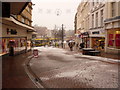
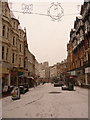
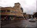
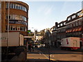
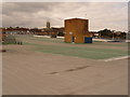
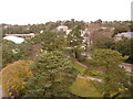
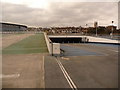
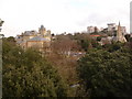
Photos of BH1 1HF


Area Information
BH1 1HF is a small residential postcode cluster in Bournemouth, Dorset, forming part of the Bournemouth Central electoral ward. Situated in the heart of Bournemouth’s urban core, it lies between West Cliff and East Cliff, within walking distance of the town’s historic landmarks. The area has a population of 1,230, reflecting its compact nature. As Bournemouth’s central business district, it is defined by a mix of historic architecture and modern retail, with landmarks such as the Royal Exeter Hotel (1812) and Bournemouth Town Hall (1885) anchoring its character. The ward is notably diverse, with residents employed in sectors like retail, hospitality, and finance. Daily life here is shaped by proximity to coastal amenities, rail networks, and a concentration of services. While the area is urban, it retains a distinct identity through its blend of historic buildings and practical infrastructure, making it a focal point for both residents and visitors.
- Area Type
- Postcode
- Area Size
- Not available
- Population
- Not available
- Population Density
- Not available
The property market in BH1 1HF is characterised by a low home ownership rate (23%) and a reliance on flats as the primary accommodation type. This suggests that the area functions more as a rental market than an owner-occupied one, with limited availability of larger homes or detached properties. The small population and compact postcode area mean housing stock is constrained, making it a niche market for buyers seeking long-term investment. Flats dominate, likely concentrated in purpose-built residential blocks or converted buildings within the urban core. For buyers, this implies limited scope for property expansion or redevelopment, though proximity to amenities like rail networks and coastal access may offset this. The market is likely competitive, with demand driven by students, professionals working in nearby sectors, and those seeking short-term housing in Bournemouth’s central area.
House Prices in BH1 1HF
Showing 1 properties
| Address | Type | Beds | Baths | Last Sale Price | Last Sale Date | |
|---|---|---|---|---|---|---|
| G E Bridge & Co, 123-125 Old Christchurch Road, Bournemouth, BH1 1HF | retail_financial | - | - | - | - |
Energy Efficiency in BH1 1HF
Living in BH1 1HF offers access to a range of amenities within close proximity. Retail options include major stores such as Tesco Bournemouth, Asda Bath, and The Southern Co-operative, providing everyday shopping convenience. The area is served by five railway stations, including Bournemouth Railway Station, enabling swift travel to nearby towns and cities. For those seeking coastal access, ferry landings like Tuckton Tea Gardens and Christchurch Quay are nearby, offering links to nearby waterways and scenic routes. The presence of two airports, Bournemouth and Bournemouth International, further enhances connectivity. The urban setting blends practicality with historic charm, with landmarks like the Pavilion Theatre and Bournemouth International Centre adding cultural value. This mix of retail, transport, and leisure facilities supports a lifestyle that balances convenience with access to Bournemouth’s coastal and urban attractions.
Amenities
Schools
| Rank | School | Type | Entry gender | Ages |
|---|
Explore more schools in this area
Go to Schools tabDemographics
The population of BH1 1HF has a median age of 22, with the most common age range being 15–29 years. This indicates a young, dynamic community, likely influenced by student populations and early-career professionals. Home ownership in the area is low at 23%, suggesting a predominance of rental properties. The primary accommodation type is flats, reflecting the area’s compact, urban layout. The predominant ethnic group is White, though the ward is described as the most diverse in Bournemouth, implying a mix of backgrounds. The age profile and high proportion of renters suggest a transient population, possibly linked to student housing or short-term employment. This demographic structure shapes the area’s social fabric, with a focus on shared spaces and community amenities rather than long-term residential stability.
Household Size
Accommodation Type
Tenure
Ethnic Group
Religion
Household Composition
Age
Household Deprivation
NS-SEC
Explore more demographic insights in this area
Go to Demographics tabPlanning
Planning Constraints
- Flood RiskPremium
- Ramsar Wetland SitesPremium
- Area of Outstanding Natural BeautyPremium
- Protected Nature ReservePremium
- Protected WoodlandPremium