Area Overview for Batheaston
Photos of Batheaston


Area Information
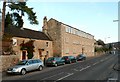
Bathaston is a compact built-up area spanning 1.5 km², situated in England. Its population, while not explicitly stated, is reflected in its demographics, with a median age of 70, suggesting a community skewed towards older residents. This area is defined by its proximity to essential services and transport links, making it practical for daily life. The presence of five rail stations, including Bath Spa and Oldfield Park, underscores its connectivity to broader regional networks. Nearby, retail options like Spar Batheaston and Co-op Larkhall provide convenience for routine shopping. For families, Batheaston offers a mix of primary and academy schools, with Batheaston Church School rated ‘good’ by Ofsted. While the area’s older demographic may influence its social dynamics, its low crime risk score of 84/100 indicates a safe environment. Living here balances accessibility with a quieter, established character, ideal for those prioritising security and ease of movement.
- Area Type
- Built Up Area 250
- Area Size
- 1.5 km²
- Population
- Not available
- Population Density
- Not available
Bathaston’s residents have access to a range of amenities within easy reach. Retail options include Spar Batheaston, Spar Bathampton, and Co-op Larkhall, offering essentials for daily living. The five rail stations—such as Oldfield Park and Bath Spa—enhance connectivity to nearby towns and cities, supporting both work and leisure travel. While the data does not mention parks or leisure facilities, the presence of schools and shops suggests a community focused on practicality and accessibility. The area’s compact size means amenities are closely clustered, reducing the need for long commutes. This convenience, combined with the low crime risk, contributes to a lifestyle that prioritises security and ease of access to services.
Amenities
Schools
Bathaston’s schools include Batheaston CofE Primary School, a primary institution serving younger children, and Batheaston Church School, an academy with a ‘good’ Ofsted rating. These options provide a range of educational settings, from early years to secondary-level provision, though the data does not specify the latter’s exact age range. The presence of an academy suggests a focus on structured, possibly academically oriented education, while the primary school offers a more traditional foundation. Families seeking a mix of school types may find this combination beneficial, though the lack of additional schools or specific performance metrics limits deeper analysis. The ‘good’ rating at Batheaston Church School indicates a reliable option for parents prioritising quality education.
| Rank | School | Type | Entry gender | Ages |
|---|
Explore more schools in this area
Go to Schools tabDemographics
Bathaston’s population has a median age of 70, the highest in the dataset, indicating a predominantly older community. This age profile suggests a demographic where retirement and long-term residency are common. Home ownership is high, with 76% of residents owning their homes, reflecting a stable, settled population. The data does not specify household composition or accommodation types, but the overall ownership rate implies a community less reliant on rental properties. The lack of detailed information on diversity or deprivation means broader social trends are not quantified here. However, the low crime risk score of 84/100, described as ‘below average,’ suggests a safe environment for residents. This stability, combined with the area’s age profile, may appeal to those seeking a secure, low-maintenance lifestyle.
Household Size
Accommodation Type
Tenure
Ethnic Group
Religion
Household Composition
Age
Household Deprivation
NS-SEC
Explore more demographic insights in this area
Go to Demographics tabPlanning
Planning Constraints
- Crime RiskPremium