Area Overview for Barnstaple with Westacott Ward
Photos of Barnstaple with Westacott Ward
Area Information
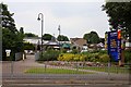
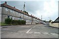
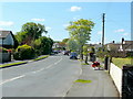
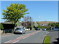
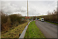
Barnstaple with Westacott Ward covers a compact 2.9 km² district within Devon. This small area defines a specific local environment rather than a sprawling urban zone. Residents here experience a very defined sense of place because the footprint is so limited. Living in Barnstaple with Westacott Ward means navigating a neighbourhood where distances are short and amenities are likely within walking distance. The area functions as a distinct part of the broader Barnstaple borough unitary authority. You do not find the wide variety of zones that larger cities offer, yet this concentration creates immediate access to local facilities. The ward operates as a tightly knit unit where daily routines often centre on the immediate surroundings. Prospective buyers looking at homes in Barnstaple with Westacott Ward should appreciate the simplicity of this scale. There are no hidden suburbs or disconnected pockets of development to discover after purchase. The whole area is accessible within a single stretch of ground. This dimensionality shapes the rhythm of daily life for everyone residing here. You move through familiar streets and established patterns rather than complex urban sprawl. The local character remains consistent from one end of the ward to the other.
- Area Type
- District Borough Unitary Ward
- Area Size
- 2.9 km²
- Population
- Not available
- Population Density
- Not available
Demographics
The community profile reveals an older population with a median age of 70 years. This demographic shifts the social fabric toward retirees or those older in life. Barnstaple with Westacott Ward is significantly older than the national average. The residents here are likely families with grown children or single older adults. You will find fewer young households compared to other parts of the country. Homeownership stands at 53 per cent of the total household composition. More than half of the people living in Barnstaple with Westacott Ward own their own property. This indicates a settled community with residents invested in long-term stability. The predominant ethnic group, religion, and accommodation type data are not available in the current records. You should focus on the clear age and ownership metrics when evaluating the community feel. The high age profile suggests specific needs, perhaps related to healthcare or leisure suited to mature residents. Living in this area means engaging with an established demographic rather than a transient youth culture. This stability often translates into quieter streets and a different pace of life. Homes in Barnstaple with Westacott Ward cater primarily to an older clientele.
Household Size
Accommodation Type
Tenure
Ethnic Group
Religion
Household Composition
Age
Household Deprivation
NS-SEC
Explore more demographic insights in this area
Go to Demographics tabPlanning
Planning Constraints
- Flood RiskPremium
- Ramsar Wetland SitesPremium
- Area of Outstanding Natural BeautyPremium
- Protected Nature ReservePremium
- Protected WoodlandPremium
- Crime RiskPremium