Area Overview for Barnstaple Central Ward
Photos of Barnstaple Central Ward

Area Information
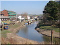
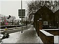
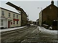
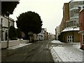
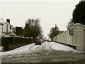
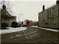
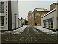
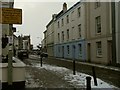
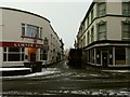
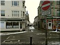
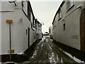
Barnstaple Central Ward sits within the historic market town of Barnstaple in North Devon, spanning a compact 58.3 hectares. This district occupies a strategic position at the lowest crossing point of the River Taw, approximately six miles inland from the bay. The ward represents an electoral division inside Barnstaple, the largest settlement in the county, and reflects the town's deep roots dating back to its medieval layout. You will find that contemporary street names still reference early city planning, with Boutport Street following the curve of ancient ditches and The Strand marking a historic centre of shipbuilding. The modern ward incorporates areas that developed through ribbon expansion between the 1930s and 1950s, including the villages of Pilton, Newport, and Roundswell. Life here offers direct access to the A39 Atlantic Highway, which connects the location to Bideford, Bude, and the coast of Cornwall. The landmark Barnstaple Long Bridge with its sixteen arches remains a defining feature of the landscape. You do not need to worry about planning constraints related to Ramsar sites, Areas of Outstanding Natural Beauty, or protected woodlands within these specific boundaries. Instead, you arrive in a fully developed urban ward where the physical infrastructure connects the wider Devon region with the Bristol Channel coast.
- Area Type
- District Borough Unitary Ward
- Area Size
- 58.3 hectares
- Population
- Not available
- Population Density
- Not available
Demographics
The community profile for living in Barnstaple Central Ward shows a distinct lack of recent data regarding specific age breakdowns, household composition, and ethnic diversity. The median age recorded for this ward stands at 70 years, indicating a population heavily skewed towards older residents. While the ward covers 58.3 hectares, you will not find detailed statistics on how this population is distributed across different age ranges or specific ethnic groups. Religious affiliation data is also absent from the local records. This demographic picture suggests a settlement where the traditional working-age population may be less prevalent than in many other UK towns. Because the data does not provide breakdowns for age ranges, household types, or predominant ethnic groups, you cannot make precise claims about the generational mix in the ward. The absence of this information limits the ability to describe the nuanced social fabric of Barnstaple Central Ward with the usual level of detail. You must rely on the confirmed median age figure to understand the likely character of the neighbourhood, acknowledging that the other specific demographic metrics remain unquantified for this zone.
Household Size
Accommodation Type
Tenure
Ethnic Group
Religion
Household Composition
Age
Household Deprivation
NS-SEC
Explore more demographic insights in this area
Go to Demographics tabPlanning
Planning Constraints
- Flood RiskPremium
- Ramsar Wetland SitesPremium
- Area of Outstanding Natural BeautyPremium
- Protected Nature ReservePremium
- Protected WoodlandPremium
- Crime RiskPremium