Area Overview for Bagpath
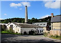
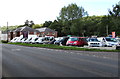
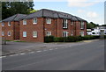
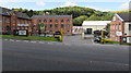
Photos of Bagpath


Area Information
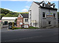
Bagpath is a compact built-up area in England, spanning 23.5 hectares. Its population is characterised by a median age of 70, suggesting a community skewed towards older residents. This demographic profile shapes the area’s rhythm, with a focus on stability and familiarity. The high home ownership rate of 88% reinforces a sense of permanence, with most properties likely to be family-owned rather than rented. Daily life here is defined by proximity to essential services. Within practical reach are three railway stations—Stroud, Stonehouse, and Cam & Dursley—offering connections to nearby towns. Retail options include Aldi on Bath Road and Waitrose in Stroud, ensuring access to groceries and convenience stores. The area’s safety score of 87/100, rated as low risk, adds to its appeal for those prioritising security. While the broadband score is poor at 23, mobile coverage is strong at 83, balancing limitations in home working with reliable connectivity on the move. Bagpath’s compact size and established infrastructure make it a practical choice for those seeking a quiet, well-connected community with a distinct demographic profile.
- Area Type
- Built Up Area 250
- Area Size
- 23.5 hectares
- Population
- Not available
- Population Density
- Not available
Residents of Bagpath have access to a range of amenities within practical reach, enhancing daily convenience. Retail options include Aldi on Bath Road, Waitrose in Stroud, and Iceland in Stroud, providing a variety of grocery and convenience shopping. The three railway stations—Stroud, Stonehouse, and Cam & Dursley—offer direct links to nearby towns and cities, facilitating commuting or weekend travel. While the data does not mention parks or leisure facilities, the presence of multiple retail and transport hubs suggests a focus on practicality over expansive recreational spaces. The compact nature of the area ensures that essential services are within walking or short driving distance, reducing the need for long commutes. This balance of retail, transport, and proximity to larger towns makes Bagpath a functional choice for those prioritising accessibility and convenience in their daily lives.
Amenities
Schools
| Rank | School | Type | Entry gender | Ages |
|---|
Explore more schools in this area
Go to Schools tabDemographics
The population of Bagpath has a median age of 70, the highest in the dataset, indicating a community predominantly composed of older adults. This age profile influences the area’s social dynamics, with fewer young families and a higher proportion of retired individuals. Home ownership is exceptionally high at 88%, suggesting a stable housing market with long-term residents. The data does not specify household composition or accommodation types, but the overall figures imply a mix of family homes and single-occupancy properties. The absence of detailed ethnic or religious breakdowns means diversity metrics cannot be quantified, though the area’s homogeneity is evident from the aggregated statistics. The high age bracket may affect local services, with healthcare and leisure facilities likely tailored to older residents. While no deprivation data is provided, the safety score of 87/100 and access to amenities suggest a quality of life that balances simplicity with practicality for this demographic.
Household Size
Accommodation Type
Tenure
Ethnic Group
Religion
Household Composition
Age
Household Deprivation
NS-SEC
Explore more demographic insights in this area
Go to Demographics tabPlanning
Planning Constraints
- Crime RiskPremium