Area Overview for BA9 9NS
Photos of BA9 9NS
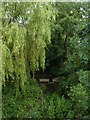
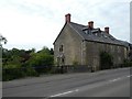
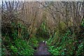
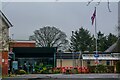
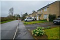
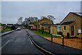
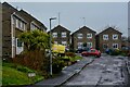
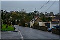
45 photos from this area
Area Information
Key information about the BA9 9NS including its size, population, and administrative classification.
- Area Type
- Postcode
- Area Size
- 1.9 hectares
- Population
- 2282
- Population Density
- 666 people/km²
House Prices in BA9 9NS
30
Properties
£203,652
Average Sold Price
£69,950
Lowest Price
£415,000
Highest Price
Showing 30 properties
| Address | Type | Beds | Baths | Last Sale Price | Last Sale Date | |
|---|---|---|---|---|---|---|
| 30 Grants Close, Wincanton, BA9 9NS | house | 4 | 2 | £415,000 | Apr 2023 | |
| 9 Grants Close, Wincanton, BA9 9NS | Detached | 4 | 2 | £390,000 | Oct 2022 | |
| 11 Grants Close, Wincanton, BA9 9NS | Detached | 4 | 2 | £296,000 | Jan 2020 | |
| 25 Grants Close, Wincanton, BA9 9NS | Detached | 4 | - | £282,500 | May 2018 | |
| 7 Grants Close, Wincanton, BA9 9NS | Detached | 4 | 2 | £258,000 | Jul 2017 | |
| 29 Grants Close, Wincanton, BA9 9NS | house | - | - | £265,000 | Oct 2016 | |
| 21 Grants Close, Wincanton, BA9 9NS | Detached | 4 | - | £275,000 | Mar 2015 | |
| 15 Grants Close, Wincanton, BA9 9NS | house | - | - | £285,000 | Jul 2014 | |
| 14 Grants Close, Wincanton, BA9 9NS | house | - | - | £240,000 | Jul 2013 | |
| 1 Grants Close, Wincanton, BA9 9NS | Detached | 4 | 2 | £268,000 | Aug 2007 |
Page 1 of 3
Energy Efficiency in BA9 9NS
Amenities
Schools
| Rank | School | Type | Entry gender | Ages |
|---|
Explore more schools in this area
Go to Schools tabDemographics
Household Size
Two person
most common
Accommodation Type
Houses
most common
Tenure
72
majority
Ethnic Group
White
most common
Religion
N/A
most common
Household Composition
N/A
most common
Age
47
median
Adults (30-64 years)
most common
Household Deprivation
N/A
with no deprivation
NS-SEC
29
in Lower managerial occupations
Explore more demographic insights in this area
Go to Demographics tabPlanning
Planning Constraints
- Flood RiskPremium
- Ramsar Wetland SitesPremium
- Area of Outstanding Natural BeautyPremium
- Protected Nature ReservePremium
- Protected WoodlandPremium