Area Overview for BA7 7EU
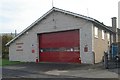
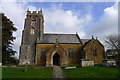
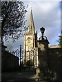
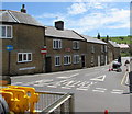
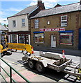
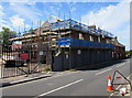
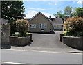
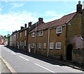
Photos of BA7 7EU

Area Information
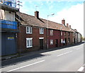
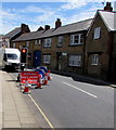
Living in BA7 7EU means inhabiting a small, tightly knit rural community in south Somerset. This postcode area, covering just 2.1 hectares, is part of Castle Cary, a historic market town with roots dating back to the 11th century. The population of 1,756 reflects a mature demographic, with a median age of 47 and most residents aged 30–64. Daily life here is shaped by the surrounding countryside, with the River Cary nearby and a mix of traditional architecture and modern amenities. The area’s compact size fosters a close-knit feel, where local landmarks like the Church of All Saints and the Market House stand as reminders of its heritage. Proximity to nearby towns like Wincanton and Shepton Mallet offers access to broader services, while the rural setting ensures a quieter, slower pace of life. For those seeking a balance between history and practicality, BA7 7EU offers a distinctive blend of charm and accessibility.
- Area Type
- Postcode
- Area Size
- 2.1 hectares
- Population
- 1756
- Population Density
- 332 people/km²
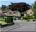
The property market in BA7 7EU is characterised by high home ownership (79%) and a predominance of houses over other accommodation types. This suggests a market skewed towards owner-occupied properties rather than rentals, reflecting the area’s rural, settled nature. With a population of just 1,756 spread over 2.1 hectares, the housing stock is likely limited in scale, with properties concentrated in the small residential cluster of Castle Cary. Buyers should expect a focus on traditional homes, possibly with historical features, given the town’s heritage. The compact size of the area means the immediate surroundings may hold more options, but demand could outstrip supply for desirable properties. For those seeking a low-density, owner-occupied lifestyle, BA7 7EU offers a niche market with a strong sense of community.
House Prices in BA7 7EU
No properties found in this postcode.
Energy Efficiency in BA7 7EU
The lifestyle in BA7 7EU is shaped by its rural setting and proximity to Castle Cary’s amenities. Residents have access to five notable retail outlets, including Morrisons Daily Castle, Co-op Castle, and Budgens Bruton, ensuring everyday shopping needs are met. The two nearby railway stations, Castle Cary and Bruton, offer regular services for commuting or leisure travel. While the area’s small size limits large-scale leisure facilities, the surrounding countryside provides opportunities for outdoor activities. The presence of historic sites like the Church of All Saints and the Market House adds cultural value to daily life. This blend of practical retail, transport links, and heritage makes BA7 7EU a convenient base for those prioritising a quiet, connected rural existence.
Amenities
Schools
Residents of BA7 7EU have access to a range of local schools, including Castle Cary Community Primary School and Ansford School, both of which are primary institutions. Ansford Academy, an academy school, holds an Ofsted rating of satisfactory, providing a secondary education option for the area. The presence of both primary and academy schools offers families a choice of educational pathways, though the limited number of schools suggests a small catchment area. The mix of school types reflects the area’s role as a rural market town, balancing local provision with the need for broader educational resources. Parents should consider the proximity of these schools to their homes, as the small population and compact layout of BA7 7EU mean travel times are likely minimal.
| Rank | School | Type | Entry gender | Ages |
|---|
Explore more schools in this area
Go to Schools tabDemographics
The community in BA7 7EU is predominantly composed of adults aged 30–64, with a median age of 47. This suggests a stable, mature population, likely with long-term ties to the area. Home ownership is high at 79%, with most properties being houses rather than flats or apartments. The predominant ethnic group is White, reflecting the area’s rural character and historical settlement patterns. The population density of 332 people per square kilometre indicates a low-density, spread-out settlement typical of small market towns. This demographic profile suggests a community focused on established living, with fewer transient residents. The absence of specific data on deprivation means quality of life is inferred from the area’s low crime risk and strong digital connectivity, which support a functional, self-sufficient lifestyle.
Household Size
Accommodation Type
Tenure
Ethnic Group
Religion
Household Composition
Age
Household Deprivation
NS-SEC
Explore more demographic insights in this area
Go to Demographics tabPlanning
Planning Constraints
- Flood RiskPremium
- Ramsar Wetland SitesPremium
- Area of Outstanding Natural BeautyPremium
- Protected Nature ReservePremium
- Protected WoodlandPremium