Area Overview for BA6 9BY
Photos of BA6 9BY
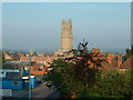
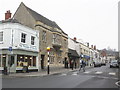
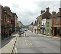
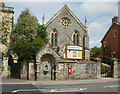
100 photos from this area
Area Information
Key information about the BA6 9BY including its size, population, and administrative classification.
- Area Type
- Postcode
- Area Size
- 1.0 hectares
- Population
- 2673
- Population Density
- 893 people/km²
House Prices in BA6 9BY
15
Properties
£321,521
Average Sold Price
£125,750
Lowest Price
£700,000
Highest Price
Showing 15 properties
| Address | Type | Beds | Baths | Last Sale Price | Last Sale Date | |
|---|---|---|---|---|---|---|
| 77 Wells Road, Glastonbury, BA6 9BY | Bungalow | 3 | 2 | £420,000 | Jul 2024 | |
| 65 Wells Road, Glastonbury, BA6 9BY | house | 5 | 4 | £700,000 | May 2024 | |
| 69 Wells Road, Glastonbury, BA6 9BY | house | - | - | £468,000 | Sep 2022 | |
| 51 Wells Road, Glastonbury, BA6 9BY | Semi-detached | 3 | 1 | £205,000 | Mar 2019 | |
| 75 Wells Road, Glastonbury, BA6 9BY | house | - | - | £345,000 | Oct 2017 | |
| 79 Wells Road, Glastonbury, BA6 9BY | Detached | 4 | 2 | £420,000 | Jan 2015 | |
| 67 Wells Road, Glastonbury, BA6 9BY | Detached | 3 | 1 | £362,500 | Oct 2013 | |
| 49 Wells Road, Glastonbury, BA6 9BY | house | 5 | 2 | £194,000 | Jul 2010 | |
| 61 Wells Road, Glastonbury, BA6 9BY | Semi-detached | 4 | 1 | £228,000 | Feb 2003 | |
| 83 Wells Road, Glastonbury, BA6 9BY | Detached | - | - | £250,000 | Jan 2003 |
Page 1 of 2
Energy Efficiency in BA6 9BY
Amenities
Schools
| Rank | School | Type | Entry gender | Ages |
|---|
Explore more schools in this area
Go to Schools tabDemographics
Household Size
Two person
most common
Accommodation Type
Houses
most common
Tenure
69
majority
Ethnic Group
White
most common
Religion
N/A
most common
Household Composition
N/A
most common
Age
47
median
Adults (30-64 years)
most common
Household Deprivation
N/A
with no deprivation
NS-SEC
29
in Lower managerial occupations
Explore more demographic insights in this area
Go to Demographics tabPlanning
Planning Constraints
- Flood RiskPremium
- Ramsar Wetland SitesPremium
- Area of Outstanding Natural BeautyPremium
- Protected Nature ReservePremium
- Protected WoodlandPremium