Area Overview for BA6 9AJ
Photos of BA6 9AJ
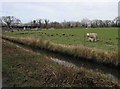

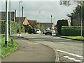
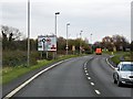
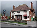
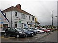
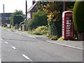
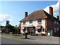
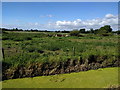
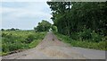
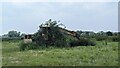
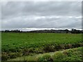
14 photos from this area
Area Information
Key information about the BA6 9AJ including its size, population, and administrative classification.
- Area Type
- Postcode
- Area Size
- 8825 m²
- Population
- 2673
- Population Density
- 893 people/km²
House Prices in BA6 9AJ
12
Properties
£254,575
Average Sold Price
£117,500
Lowest Price
£302,000
Highest Price
Showing 12 properties
| Address | Type | Beds | Baths | Last Sale Price | Last Sale Date | |
|---|---|---|---|---|---|---|
| 125 Wells Road, Glastonbury, BA6 9AJ | Semi-detached | 3 | 1 | £302,000 | Nov 2024 | |
| 127 Wells Road, Glastonbury, BA6 9AJ | Terraced | 3 | 1 | £300,000 | Sep 2022 | |
| 121 Wells Road, Glastonbury, BA6 9AJ | Terraced | 3 | 2 | £270,000 | May 2021 | |
| 127A Wells Road, Glastonbury, BA6 9AJ | Detached | 3 | 2 | £299,950 | Jul 2018 | |
| 115 Wells Road, Glastonbury, BA6 9AJ | Detached | 4 | 1 | £238,000 | Jul 2003 | |
| 111 Wells Road, Glastonbury, BA6 9AJ | Detached | - | - | £117,500 | Jul 2001 | |
| 123 Wells Road, Glastonbury, BA6 9AJ | Terraced | - | - | - | - | |
| Waggon And Horses, 113 Wells Road, Glastonbury, BA6 9AJ | restaurant_cafe | - | - | - | - | |
| 117 Wells Road, Glastonbury, BA6 9AJ | Terraced | - | - | - | - | |
| 129 Wells Road, Glastonbury, BA6 9AJ | Semi-detached | - | - | - | - |
Page 1 of 2
Energy Efficiency in BA6 9AJ
Amenities
Schools
| Rank | School | Type | Entry gender | Ages |
|---|
Explore more schools in this area
Go to Schools tabDemographics
Household Size
Two person
most common
Accommodation Type
Houses
most common
Tenure
69
majority
Ethnic Group
White
most common
Religion
N/A
most common
Household Composition
N/A
most common
Age
47
median
Adults (30-64 years)
most common
Household Deprivation
N/A
with no deprivation
NS-SEC
29
in Lower managerial occupations
Explore more demographic insights in this area
Go to Demographics tabPlanning
Planning Constraints
- Flood RiskPremium
- Ramsar Wetland SitesPremium
- Area of Outstanding Natural BeautyPremium
- Protected Nature ReservePremium
- Protected WoodlandPremium