Area Overview for BA5 2HA
Photos of BA5 2HA
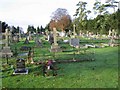
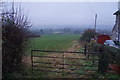
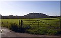
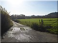
32 photos from this area
Area Information
Key information about the BA5 2HA including its size, population, and administrative classification.
- Area Type
- Postcode
- Area Size
- 8150 m²
- Population
- 1728
- Population Density
- 2280 people/km²
House Prices in BA5 2HA
22
Properties
£198,689
Average Sold Price
£52,000
Lowest Price
£340,000
Highest Price
Showing 22 properties
| Address | Type | Beds | Baths | Last Sale Price | Last Sale Date | |
|---|---|---|---|---|---|---|
| 55 Jocelyn Drive, Wells, BA5 2HA | Terraced | 4 | 2 | £340,000 | Aug 2025 | |
| 51 Jocelyn Drive, Wells, BA5 2HA | Terraced | 2 | 1 | £245,000 | May 2025 | |
| 74 Jocelyn Drive, Wells, BA5 2HA | Semi-detached | 3 | 1 | £282,000 | Nov 2024 | |
| 53 Jocelyn Drive, Wells, BA5 2HA | Terraced | 2 | 1 | £245,000 | Mar 2023 | |
| 39 Jocelyn Drive, Wells, BA5 2HA | Semi-detached | 2 | - | £250,000 | Dec 2021 | |
| 57 Jocelyn Drive, Wells, BA5 2HA | house | - | - | £280,000 | Nov 2021 | |
| 41 Jocelyn Drive, Wells, BA5 2HA | Semi-detached | 3 | 1 | £200,000 | Aug 2020 | |
| 56 Jocelyn Drive, Wells, BA5 2HA | Semi-detached | 3 | - | £259,000 | Aug 2016 | |
| 72 Jocelyn Drive, Wells, BA5 2HA | Semi-detached | 3 | 1 | £183,000 | Mar 2015 | |
| 70 Jocelyn Drive, Wells, BA5 2HA | Semi-detached | 3 | - | £158,000 | Jul 2013 |
Page 1 of 3
Energy Efficiency in BA5 2HA
Amenities
Schools
| Rank | School | Type | Entry gender | Ages |
|---|
Explore more schools in this area
Go to Schools tabDemographics
Household Size
Two person
most common
Accommodation Type
Houses
most common
Tenure
73
majority
Ethnic Group
White
most common
Religion
N/A
most common
Household Composition
N/A
most common
Age
47
median
Adults (30-64 years)
most common
Household Deprivation
N/A
with no deprivation
NS-SEC
35
in Lower managerial occupations
Explore more demographic insights in this area
Go to Demographics tabPlanning
Planning Constraints
- Flood RiskPremium
- Ramsar Wetland SitesPremium
- Area of Outstanding Natural BeautyPremium
- Protected Nature ReservePremium
- Protected WoodlandPremium