Area Overview for BA4 6LE
Photos of BA4 6LE
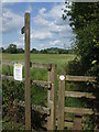
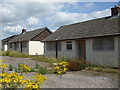
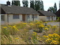
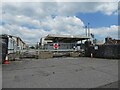
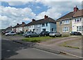
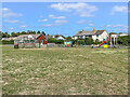

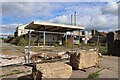
26 photos from this area
Area Information
Key information about the BA4 6LE including its size, population, and administrative classification.
- Area Type
- Postcode
- Area Size
- 4877 m²
- Population
- 1570
- Population Density
- 77 people/km²
House Prices in BA4 6LE
14
Properties
£187,455
Average Sold Price
£142,000
Lowest Price
£255,000
Highest Price
Showing 14 properties
| Address | Type | Beds | Baths | Last Sale Price | Last Sale Date | |
|---|---|---|---|---|---|---|
| 51 Maesdown Road, Evercreech, Shepton Mallet, BA4 6LE | Semi-detached | 2 | 1 | £190,000 | May 2025 | |
| 56 Maesdown Road, Evercreech, Shepton Mallet, BA4 6LE | Semi-detached | 2 | 2 | £207,500 | Feb 2025 | |
| 52 Maesdown Road, Evercreech, Shepton Mallet, BA4 6LE | house | - | - | £229,000 | Mar 2022 | |
| 47 Maesdown Road, Evercreech, Shepton Mallet, BA4 6LE | Semi-detached | 3 | 2 | £255,000 | Dec 2021 | |
| 43 Maesdown Road, Evercreech, Shepton Mallet, BA4 6LE | house | - | - | £250,000 | Oct 2019 | |
| Hawthorn, 48B Maesdown Road, Evercreech, Shepton Mallet, BA4 6LE | Semi-detached | - | - | £163,500 | Jul 2017 | |
| Cherry Tree, 48A Maesdown Road, Evercreech, Shepton Mallet, BA4 6LE | Semi-detached | 3 | - | £152,000 | Mar 2017 | |
| 58 Maesdown Road, Evercreech, Shepton Mallet, BA4 6LE | house | - | - | £146,500 | Jul 2016 | |
| 49 Maesdown Road, Evercreech, Shepton Mallet, BA4 6LE | house | - | - | £142,000 | Jan 2016 | |
| 48 Maesdown Road, Evercreech, Shepton Mallet, BA4 6LE | house | 4 | - | £171,500 | Dec 2013 |
Page 1 of 2
Energy Efficiency in BA4 6LE
Amenities
Schools
| Rank | School | Type | Entry gender | Ages |
|---|
Explore more schools in this area
Go to Schools tabDemographics
Household Size
Two person
most common
Accommodation Type
Houses
most common
Tenure
77
majority
Ethnic Group
White
most common
Religion
N/A
most common
Household Composition
N/A
most common
Age
47
median
Adults (30-64 years)
most common
Household Deprivation
N/A
with no deprivation
NS-SEC
35
in Lower managerial occupations
Explore more demographic insights in this area
Go to Demographics tabPlanning
Planning Constraints
- Flood RiskPremium
- Ramsar Wetland SitesPremium
- Area of Outstanding Natural BeautyPremium
- Protected Nature ReservePremium
- Protected WoodlandPremium