Area Overview for BA4 6JS
Photos of BA4 6JS
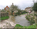
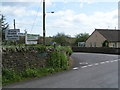
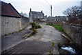
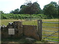
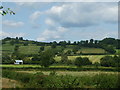
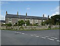
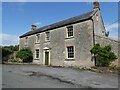
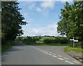
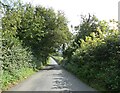
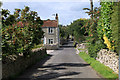
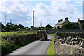
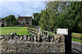
26 photos from this area
Area Information
Key information about the BA4 6JS including its size, population, and administrative classification.
- Area Type
- Postcode
- Area Size
- 15.7 hectares
- Population
- 1570
- Population Density
- 77 people/km²
House Prices in BA4 6JS
23
Properties
£344,406
Average Sold Price
£60,000
Lowest Price
£1,649,998
Highest Price
Showing 23 properties
| Address | Type | Beds | Baths | Last Sale Price | Last Sale Date | |
|---|---|---|---|---|---|---|
| Wellesley House, Shapway Lane, Evercreech, Shepton Mallet, BA4 6JS | house | - | - | £900,000 | Dec 2023 | |
| The Glen Nursing Home, Shapway Lane, Evercreech, Shepton Mallet, BA4 6JS | hospital_care_home | - | - | £1,649,998 | Apr 2022 | |
| Cloverlea, Shapway Lane, Evercreech, Shepton Mallet, BA4 6JS | Detached | 3 | - | £345,000 | Jul 2018 | |
| 3, The Glen Bungalows, Shapway Lane, Evercreech, Shepton Mallet, BA4 6JS | Bungalow | - | - | £110,000 | Jul 2018 | |
| Shawfield, Shapway Lane, Evercreech, Shepton Mallet, BA4 6JS | house | - | - | £334,000 | Jun 2017 | |
| 1, The Glen Bungalows, Shapway Lane, Evercreech, Shepton Mallet, BA4 6JS | Bungalow | 1 | - | £88,000 | Mar 2016 | |
| 2, The Glen Bungalows, Shapway Lane, Evercreech, Shepton Mallet, BA4 6JS | Bungalow | 1 | 1 | £83,500 | Jun 2015 | |
| Meadow View, Shapway Lane, Evercreech, Shepton Mallet, BA4 6JS | Detached | 4 | - | £328,000 | Apr 2014 | |
| 6, The Glen Bungalows, Shapway Lane, Evercreech, Shepton Mallet, BA4 6JS | Bungalow | - | - | £115,000 | Jul 2013 | |
| Yarbrook, Shapway Lane, Evercreech, Shepton Mallet, BA4 6JS | Detached | 4 | 2 | £550,000 | Aug 2010 |
Page 1 of 3
Energy Efficiency in BA4 6JS
Amenities
Schools
| Rank | School | Type | Entry gender | Ages |
|---|
Explore more schools in this area
Go to Schools tabDemographics
Household Size
Two person
most common
Accommodation Type
Houses
most common
Tenure
77
majority
Ethnic Group
White
most common
Religion
N/A
most common
Household Composition
N/A
most common
Age
47
median
Adults (30-64 years)
most common
Household Deprivation
N/A
with no deprivation
NS-SEC
35
in Lower managerial occupations
Explore more demographic insights in this area
Go to Demographics tabPlanning
Planning Constraints
- Flood RiskPremium
- Ramsar Wetland SitesPremium
- Area of Outstanding Natural BeautyPremium
- Protected Nature ReservePremium
- Protected WoodlandPremium