Area Overview for BA4 5ER
Photos of BA4 5ER
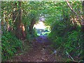
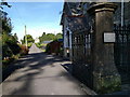
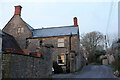
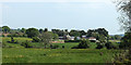
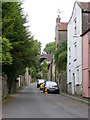
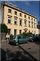
24 photos from this area
Area Information
Key information about the BA4 5ER including its size, population, and administrative classification.
- Area Type
- Postcode
- Area Size
- 9945 m²
- Population
- 1506
- Population Density
- 361 people/km²
House Prices in BA4 5ER
14
Properties
£162,130
Average Sold Price
£45,000
Lowest Price
£360,000
Highest Price
Showing 14 properties
| Address | Type | Beds | Baths | Last Sale Price | Last Sale Date | |
|---|---|---|---|---|---|---|
| 55 Cowl Street, Shepton Mallet, BA4 5ER | Detached | 2 | 1 | £232,500 | Jun 2022 | |
| Keates Cottage, 30A Cowl Street, Shepton Mallet, BA4 5ER | Detached | 2 | 1 | £360,000 | Mar 2021 | |
| 51 Cowl Street, Shepton Mallet, BA4 5ER | house | 3 | 2 | £190,000 | Mar 2021 | |
| 54 Cowl Street, Shepton Mallet, BA4 5ER | Semi-detached | 2 | 1 | £169,800 | Mar 2021 | |
| 24 Cowl Street, Shepton Mallet, BA4 5ER | house | 2 | 1 | £175,000 | Mar 2019 | |
| 25 Cowl Street, Shepton Mallet, BA4 5ER | house | - | - | £170,000 | Mar 2014 | |
| 49 Cowl Street, Shepton Mallet, BA4 5ER | Detached | - | - | £175,000 | Jan 2003 | |
| 52 Cowl Street, Shepton Mallet, BA4 5ER | Character Property | 2 | 1 | £57,000 | Jul 2001 | |
| 26 Cowl Street, Shepton Mallet, BA4 5ER | house | - | - | £47,000 | Jan 1997 | |
| 27 Cowl Street, Shepton Mallet, BA4 5ER | house | - | - | £45,000 | Aug 1995 |
Page 1 of 2
Energy Efficiency in BA4 5ER
Amenities
Schools
| Rank | School | Type | Entry gender | Ages |
|---|
Explore more schools in this area
Go to Schools tabDemographics
Household Size
Two person
most common
Accommodation Type
Houses
most common
Tenure
74
majority
Ethnic Group
White
most common
Religion
N/A
most common
Household Composition
N/A
most common
Age
47
median
Adults (30-64 years)
most common
Household Deprivation
N/A
with no deprivation
NS-SEC
33
in Lower managerial occupations
Explore more demographic insights in this area
Go to Demographics tabPlanning
Planning Constraints
- Flood RiskPremium
- Ramsar Wetland SitesPremium
- Area of Outstanding Natural BeautyPremium
- Protected Nature ReservePremium
- Protected WoodlandPremium