Area Overview for BA4 4WA
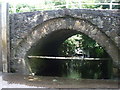
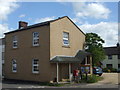
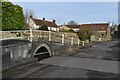
Photos of BA4 4WA

Area Information
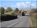
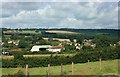
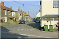
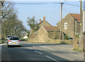
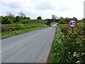
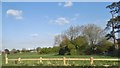
BA4 4WA is a small, tightly knit residential postcode area in England, characterised by its low population density of 38 people per square kilometre and a total population of 2321. Situated in a historically rural landscape, it lies within a civil parish with Saxon origins, including settlements like Wanstrow and Weston. The area blends traditional architecture with modern living, featuring listed buildings such as Pear Tree Cottage and the 19th-century King William IV pub. Daily life here is shaped by its proximity to Frome, a market town 9 kilometres to the north-east, offering access to broader services while maintaining a village-like atmosphere. The community is predominantly composed of homeowners aged 30–64, reflecting a mature demographic with a strong sense of local identity. With minimal planning constraints and no protected natural sites, the area offers a balance of historical charm and practical living. Residents benefit from nearby rail links to Bruton and Frome, as well as a modest selection of retail amenities. This postcode is ideal for those seeking a quieter, established community with a focus on heritage and low environmental risk.
- Area Type
- Postcode
- Area Size
- Not available
- Population
- 2321
- Population Density
- 38 people/km²
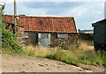
BA4 4WA is primarily an owner-occupied area, with 75% of homes owned by residents rather than rented. The accommodation type is predominantly houses, which is typical of smaller, rural or semi-rural postcode areas. This suggests a housing stock that is likely older, with many properties built in the 18th or 19th centuries, as seen in listed buildings like Sunnyside Nos. 1 & 2 and Turner’s Farm House. The limited size of the area, combined with the high home ownership rate, means the property market is likely small and competitive, with fewer options for buyers. For those considering the area, the focus on houses rather than flats may appeal to those seeking larger living spaces or garden access. However, the small scale of the postcode means that buyers should look beyond immediate surroundings to nearby towns like Frome for more extensive property choices.
House Prices in BA4 4WA
No properties found in this postcode.
Energy Efficiency in BA4 4WA
Residents of BA4 4WA have access to a modest selection of retail amenities, including Asda Nunney, Spar, and Sainsburys Frome, ensuring basic shopping needs are met locally. The nearby rail stations at Bruton and Frome provide access to broader services, dining, and leisure opportunities in nearby towns. While the area itself is small, its proximity to Frome—a market town with more extensive amenities—means residents can enjoy a mix of rural tranquillity and urban convenience. The presence of historic buildings, such as the 1877 Primitive Methodist Chapel and the 19th-century King William IV pub, adds character to daily life. The low population density and lack of major planning constraints suggest a lifestyle focused on community, heritage, and low environmental risk, making it suitable for those valuing stability and historical context.
Amenities
Schools
The nearest schools to BA4 4WA include Nunney First School, which operates both as a primary school and an academy, both with an Ofsted rating of ‘good’. Upton Noble CofE VC Primary School is also nearby, offering a primary education with the same ‘good’ rating. The presence of two primary schools with strong ratings suggests a reliable local education system for younger children. The dual status of Nunney First School as both a primary and academy may provide families with options in terms of educational approaches, though no secondary schools are listed in the data. For parents prioritising school quality, the ‘good’ ratings indicate a solid foundation for early education. However, the lack of secondary school information means families may need to look further afield for comprehensive schooling.
| Rank | School | Type | Entry gender | Ages |
|---|
Explore more schools in this area
Go to Schools tabDemographics
The population of BA4 4WA is 2321, with a median age of 47 and the majority of residents falling within the 30–64 age range. This suggests a community skewed towards middle-aged adults, likely including retired individuals and families with older children. Home ownership is high, at 75%, with the predominant accommodation type being houses rather than flats or apartments. The White ethnic group forms the largest demographic, though specific data on diversity is not provided. The low population density of 38 people per square kilometre indicates a spread-out, possibly rural or semi-rural settlement. This age profile and ownership rate imply a stable, long-term resident base, with fewer transient populations. The absence of detailed deprivation data means the quality of life cannot be fully assessed, but the high home ownership and mature demographic suggest a community with established roots and a focus on property as a long-term investment.
Household Size
Accommodation Type
Tenure
Ethnic Group
Religion
Household Composition
Age
Household Deprivation
NS-SEC
Explore more demographic insights in this area
Go to Demographics tabPlanning
Planning Constraints
- Flood RiskPremium
- Ramsar Wetland SitesPremium
- Area of Outstanding Natural BeautyPremium
- Protected Nature ReservePremium
- Protected WoodlandPremium