Area Overview for BA4 4RP
Photos of BA4 4RP
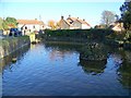
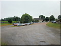
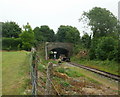
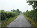

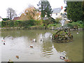
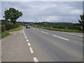
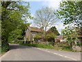
73 photos from this area
Area Information
Key information about the BA4 4RP including its size, population, and administrative classification.
- Area Type
- Postcode
- Area Size
- 25.0 hectares
- Population
- 1252
- Population Density
- 50 people/km²
House Prices in BA4 4RP
12
Properties
£397,500
Average Sold Price
£320,000
Lowest Price
£440,000
Highest Price
Showing 12 properties
| Address | Type | Beds | Baths | Last Sale Price | Last Sale Date | |
|---|---|---|---|---|---|---|
| Mullens, Ball Lane To Piers Road, Waterlip, Shepton Mallet, BA4 4RP | Detached | - | - | £440,000 | May 2023 | |
| Fairvview, Ball Lane To Piers Road, Waterlip, Shepton Mallet, BA4 4RP | Bungalow | - | - | £440,000 | Apr 2022 | |
| Westview, Ball Lane To Piers Road, Waterlip, Shepton Mallet, BA4 4RP | Bungalow | - | - | £390,000 | Nov 2020 | |
| Michedor, Ball Lane To Piers Road, Waterlip, Shepton Mallet, BA4 4RP | Bungalow | 3 | - | £320,000 | Jun 2007 | |
| 28 Ball Lane To Piers Road, Waterlip, Shepton Mallet, BA4 4RP | Detached | 4 | 1 | - | - | |
| Poppy Cottage, 25 Ball Lane To Piers Road, Waterlip, Shepton Mallet, BA4 4RP | Cottage | 4 | - | - | - | |
| Former 27, Ball Lane To Piers Road, Waterlip, Shepton Mallet, BA4 4RP | undefined | - | - | - | - | |
| 26 Ball Lane To Piers Road, Waterlip, Shepton Mallet, BA4 4RP | Cottage | 4 | - | - | - | |
| Tennis 61M From Michidor 39M From A361, Cranmore Road, Doulting, Shepton Mallet, BA4 4RP | Leisure | - | - | - | - | |
| Off Mendip, Ball Lane To Piers Road, Waterlip, Shepton Mallet, BA4 4RP | Detached | - | - | - | - |
Page 1 of 2
Energy Efficiency in BA4 4RP
Amenities
Schools
| Rank | School | Type | Entry gender | Ages |
|---|
Explore more schools in this area
Go to Schools tabDemographics
Household Size
Two person
most common
Accommodation Type
Houses
most common
Tenure
82
majority
Ethnic Group
White
most common
Religion
N/A
most common
Household Composition
N/A
most common
Age
47
median
Adults (30-64 years)
most common
Household Deprivation
N/A
with no deprivation
NS-SEC
35
in Lower managerial occupations
Explore more demographic insights in this area
Go to Demographics tabPlanning
Planning Constraints
- Flood RiskPremium
- Ramsar Wetland SitesPremium
- Area of Outstanding Natural BeautyPremium
- Protected Nature ReservePremium
- Protected WoodlandPremium