Area Overview for BA4 4QL
Photos of BA4 4QL
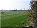
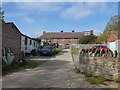
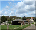
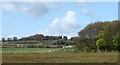
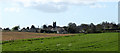
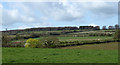
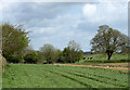
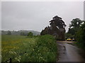
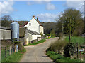
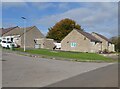
10 photos from this area
Area Information
Key information about the BA4 4QL including its size, population, and administrative classification.
- Area Type
- Postcode
- Area Size
- 8.2 hectares
- Population
- 1252
- Population Density
- 50 people/km²
House Prices in BA4 4QL
12
Properties
£548,125
Average Sold Price
£230,000
Lowest Price
£775,000
Highest Price
Showing 12 properties
| Address | Type | Beds | Baths | Last Sale Price | Last Sale Date | |
|---|---|---|---|---|---|---|
| Hunslet House, Manor Farm, Cranmore, Shepton Mallet, BA4 4QL | house | 6 | 5 | £730,000 | Jul 2018 | |
| The Beeches, Manor Farm, Cranmore, Shepton Mallet, BA4 4QL | house | 6 | - | £775,000 | Jul 2016 | |
| Magdalene House, Manor Farm, Cranmore, Shepton Mallet, BA4 4QL | house | - | - | £750,000 | Feb 2015 | |
| 7 Manor Farm, Cranmore, Shepton Mallet, BA4 4QL | Detached | 4 | 3 | £425,000 | Dec 2014 | |
| The Old Farmhouse, Manor Farm, Cranmore, Shepton Mallet, BA4 4QL | Semi-detached | - | - | £435,000 | Jan 2006 | |
| Kildare House, Manor Farm, Cranmore, Shepton Mallet, BA4 4QL | Detached | - | - | £545,000 | May 2003 | |
| Carriages, Manor Farm, Cranmore, Shepton Mallet, BA4 4QL | Detached | 6 | 1 | £495,000 | Apr 2003 | |
| Batch Cottage, Manor Farm, Cranmore, Shepton Mallet, BA4 4QL | Detached | 3 | 2 | £230,000 | Feb 2002 | |
| Fore, Manor Farm, Cranmore, Shepton Mallet, BA4 4QL | Detached | 4 | 3 | - | - | |
| The Granary, Manor Farm, Cranmore, Shepton Mallet, BA4 4QL | Detached | - | - | - | - |
Page 1 of 2
Energy Efficiency in BA4 4QL
Amenities
Schools
| Rank | School | Type | Entry gender | Ages |
|---|
Explore more schools in this area
Go to Schools tabDemographics
Household Size
Two person
most common
Accommodation Type
Houses
most common
Tenure
82
majority
Ethnic Group
White
most common
Religion
N/A
most common
Household Composition
N/A
most common
Age
47
median
Adults (30-64 years)
most common
Household Deprivation
N/A
with no deprivation
NS-SEC
35
in Lower managerial occupations
Explore more demographic insights in this area
Go to Demographics tabPlanning
Planning Constraints
- Flood RiskPremium
- Ramsar Wetland SitesPremium
- Area of Outstanding Natural BeautyPremium
- Protected Nature ReservePremium
- Protected WoodlandPremium