Area Overview for BA4 4PZ
Photos of BA4 4PZ

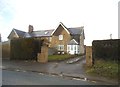
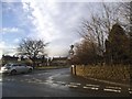
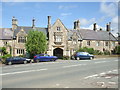
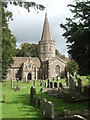
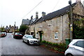
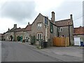
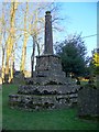
64 photos from this area
Area Information
Key information about the BA4 4PZ including its size, population, and administrative classification.
- Area Type
- Postcode
- Area Size
- 24.7 hectares
- Population
- 1252
- Population Density
- 50 people/km²
House Prices in BA4 4PZ
15
Properties
£361,240
Average Sold Price
£145,000
Lowest Price
£647,500
Highest Price
Showing 15 properties
| Address | Type | Beds | Baths | Last Sale Price | Last Sale Date | |
|---|---|---|---|---|---|---|
| Midwood, Chelynch Road, Doulting, Shepton Mallet, BA4 4PZ | Bungalow | 2 | 1 | £380,000 | Jun 2023 | |
| Bella Vista, Chelynch Road, Doulting, Shepton Mallet, BA4 4PZ | Bungalow | - | - | £399,950 | Aug 2022 | |
| Fernbank, Chelynch Road, Doulting, Shepton Mallet, BA4 4PZ | Bungalow | - | - | £647,500 | Jun 2021 | |
| Trendsber, Chelynch Road, Doulting, Shepton Mallet, BA4 4PZ | Bungalow | - | - | £310,000 | May 2021 | |
| Mahonia, Chelynch Road, Doulting, Shepton Mallet, BA4 4PZ | Bungalow | - | - | £350,000 | May 2019 | |
| Lynwood, Chelynch Road, Doulting, Shepton Mallet, BA4 4PZ | Detached | 3 | - | £375,000 | Jan 2019 | |
| Shadaroba, Chelynch Road, Doulting, Shepton Mallet, BA4 4PZ | Bungalow | 3 | 1 | £345,000 | May 2017 | |
| Lynch Court, Chelynch Road, Doulting, Shepton Mallet, BA4 4PZ | Bungalow | - | - | £279,950 | Jul 2012 | |
| Chelwood, Chelynch Road, Doulting, Shepton Mallet, BA4 4PZ | Land | 3 | - | £380,000 | Sep 2007 | |
| Eliana, Chelynch Road, Doulting, Shepton Mallet, BA4 4PZ | Detached | - | - | £145,000 | Aug 2001 |
Page 1 of 2
Energy Efficiency in BA4 4PZ
Amenities
Schools
| Rank | School | Type | Entry gender | Ages |
|---|
Explore more schools in this area
Go to Schools tabDemographics
Household Size
Two person
most common
Accommodation Type
Houses
most common
Tenure
82
majority
Ethnic Group
White
most common
Religion
N/A
most common
Household Composition
N/A
most common
Age
47
median
Adults (30-64 years)
most common
Household Deprivation
N/A
with no deprivation
NS-SEC
35
in Lower managerial occupations
Explore more demographic insights in this area
Go to Demographics tabPlanning
Planning Constraints
- Flood RiskPremium
- Ramsar Wetland SitesPremium
- Area of Outstanding Natural BeautyPremium
- Protected Nature ReservePremium
- Protected WoodlandPremium