Area Overview for BA3 5UX
Photos of BA3 5UX
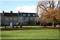
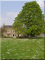
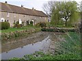
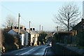
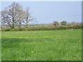
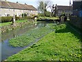
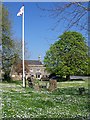
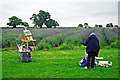
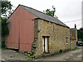
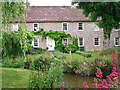
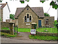

24 photos from this area
Area Information
Key information about the BA3 5UX including its size, population, and administrative classification.
- Area Type
- Postcode
- Area Size
- 1.2 hectares
- Population
- 2215
- Population Density
- 49 people/km²
House Prices in BA3 5UX
25
Properties
£361,139
Average Sold Price
£144,000
Lowest Price
£820,000
Highest Price
Showing 25 properties
| Address | Type | Beds | Baths | Last Sale Price | Last Sale Date | |
|---|---|---|---|---|---|---|
| Rowan House, High Street, Faulkland, Radstock, BA3 5UX | Detached | 5 | 3 | £820,000 | Jan 2024 | |
| West Farm, High Street, Faulkland, Radstock, BA3 5UX | Detached | 4 | 2 | £600,000 | Jun 2023 | |
| The Cedars, High Street, Faulkland, Radstock, BA3 5UX | Terraced | 3 | 2 | £367,500 | Dec 2022 | |
| Acorn Cottage, High Street, Faulkland, Radstock, BA3 5UX | Cottage | 2 | 1 | £293,000 | Mar 2022 | |
| Two Steps, High Street, Faulkland, Radstock, BA3 5UX | Retail | 4 | 1 | £310,000 | Mar 2022 | |
| Wayside, High Street, Faulkland, Radstock, BA3 5UX | house | 4 | - | £546,700 | Mar 2022 | |
| Mulberry House, High Street, Faulkland, Radstock, BA3 5UX | house | - | - | £667,500 | Feb 2021 | |
| Willow House, High Street, Faulkland, Radstock, BA3 5UX | Detached | 4 | 3 | £425,000 | Oct 2020 | |
| North Barn, High Street, Faulkland, Radstock, BA3 5UX | house | - | - | £335,000 | Aug 2019 | |
| South Barn, High Street, Faulkland, Radstock, BA3 5UX | Detached | 2 | 1 | £385,000 | Dec 2018 |
Page 1 of 3
Energy Efficiency in BA3 5UX
Amenities
Schools
| Rank | School | Type | Entry gender | Ages |
|---|
Explore more schools in this area
Go to Schools tabDemographics
Household Size
Two person
most common
Accommodation Type
Houses
most common
Tenure
78
majority
Ethnic Group
White
most common
Religion
N/A
most common
Household Composition
N/A
most common
Age
47
median
Adults (30-64 years)
most common
Household Deprivation
N/A
with no deprivation
NS-SEC
47
in Lower managerial occupations
Explore more demographic insights in this area
Go to Demographics tabPlanning
Planning Constraints
- Flood RiskPremium
- Ramsar Wetland SitesPremium
- Area of Outstanding Natural BeautyPremium
- Protected Nature ReservePremium
- Protected WoodlandPremium