Area Overview for BA3 5TX
Photos of BA3 5TX
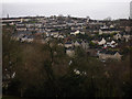
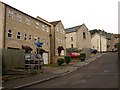
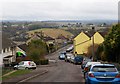
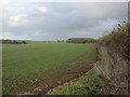
11 photos from this area
Area Information
Key information about the BA3 5TX including its size, population, and administrative classification.
- Area Type
- Postcode
- Area Size
- 5.3 hectares
- Population
- 1464
- Population Density
- 1923 people/km²
House Prices in BA3 5TX
8
Properties
-
Average Sold Price
-
Lowest Price
-
Highest Price
Showing 8 properties
| Address | Type | Beds | Baths | Last Sale Price | Last Sale Date | |
|---|---|---|---|---|---|---|
| Optima Products Ltd, Optima Products, Mill Road, Radstock, BA3 5TX | Office | - | - | - | - | |
| Unit 2 Ct Coaches, Mill Road, Radstock, BA3 5TX | storage_distribution | - | - | - | - | |
| Dart Systems Ltd, Unit 16-17, Mill Road, Radstock, BA3 5TX | storage_distribution | - | - | - | - | |
| Unit 12, Mill Road, Radstock, BA3 5TX | Industrial | - | - | - | - | |
| Curtis Steel Ltd, Unit 4 Curtis Steel Ltd, Mill Road, Radstock, BA3 5TX | Industrial | - | - | - | - | |
| Aqua Management Ltd, Mill Road, Radstock, BA3 5TX | Industrial | - | - | - | - | |
| Round Hill Roastery, Unit 11, Mill Road, Radstock, BA3 5TX | Industrial | - | - | - | - | |
| Alfie And Mollie's Dog Bakery, All Building Matters Ltd, Mill Road, Radstock, BA3 5TX | Industrial | - | - | - | - |
Energy Efficiency in BA3 5TX
Amenities
Schools
| Rank | School | Type | Entry gender | Ages |
|---|
Explore more schools in this area
Go to Schools tabDemographics
Household Size
Family (3-5 people)
most common
Accommodation Type
Houses
most common
Tenure
78
majority
Ethnic Group
White
most common
Religion
N/A
most common
Household Composition
N/A
most common
Age
47
median
Adults (30-64 years)
most common
Household Deprivation
N/A
with no deprivation
NS-SEC
29
in Lower managerial occupations
Explore more demographic insights in this area
Go to Demographics tabPlanning
Planning Constraints
- Flood RiskPremium
- Ramsar Wetland SitesPremium
- Area of Outstanding Natural BeautyPremium
- Protected Nature ReservePremium
- Protected WoodlandPremium