Area Overview for BA3 4TG
Photos of BA3 4TG
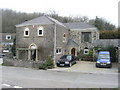
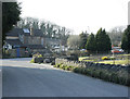
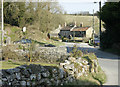
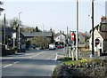
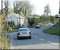
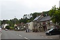
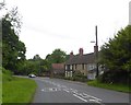
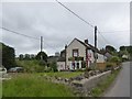
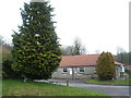
44 photos from this area
Area Information
Key information about the BA3 4TG including its size, population, and administrative classification.
- Area Type
- Postcode
- Area Size
- 11.0 hectares
- Population
- 2425
- Population Density
- 78 people/km²
House Prices in BA3 4TG
24
Properties
£249,682
Average Sold Price
£32,000
Lowest Price
£537,500
Highest Price
Showing 24 properties
| Address | Type | Beds | Baths | Last Sale Price | Last Sale Date | |
|---|---|---|---|---|---|---|
| Merann, Chapel Lane To Stockhill, Gurney Slade, Wells, BA3 4TG | Bungalow | 4 | 3 | £537,500 | Oct 2025 | |
| Underleigh, Underhill To Marchants Hill, Gurney Slade, Wells, BA3 4TG | Semi-detached | 4 | 1 | £420,000 | Feb 2025 | |
| Red Marley, Chapel Lane To Stockhill, Gurney Slade, Wells, BA3 4TG | house | - | - | £192,000 | Aug 2024 | |
| Fernleigh, Underhill To Marchants Hill, Gurney Slade, Wells, BA3 4TG | house | - | - | £270,000 | Jun 2024 | |
| Sunnyview, Chapel Lane To Stockhill, Gurney Slade, Wells, BA3 4TG | house | - | - | £125,000 | May 2020 | |
| Collingwood, Chapel Lane To Stockhill, Gurney Slade, Wells, BA3 4TG | house | - | - | £305,000 | Jul 2019 | |
| 2, Slade Cottages, Underhill To Marchants Hill, Gurney Slade, Wells, BA3 4TG | Detached | 4 | 2 | £282,000 | Jun 2019 | |
| 1, Slade Cottages, Underhill To Marchants Hill, Gurney Slade, Wells, BA3 4TG | Detached | 4 | - | £280,000 | Oct 2015 | |
| 3, Slade Cottages, Underhill To Marchants Hill, Gurney Slade, Wells, BA3 4TG | Detached | 4 | 1 | £220,000 | Jan 2013 | |
| Saffron House, Chapel Lane To Stockhill, Gurney Slade, Wells, BA3 4TG | Detached | - | - | £83,000 | Aug 1997 |
Page 1 of 3
Energy Efficiency in BA3 4TG
Amenities
Schools
| Rank | School | Type | Entry gender | Ages |
|---|
Explore more schools in this area
Go to Schools tabDemographics
Household Size
Two person
most common
Accommodation Type
Houses
most common
Tenure
79
majority
Ethnic Group
White
most common
Religion
N/A
most common
Household Composition
N/A
most common
Age
47
median
Adults (30-64 years)
most common
Household Deprivation
N/A
with no deprivation
NS-SEC
38
in Lower managerial occupations
Explore more demographic insights in this area
Go to Demographics tabPlanning
Planning Constraints
- Flood RiskPremium
- Ramsar Wetland SitesPremium
- Area of Outstanding Natural BeautyPremium
- Protected Nature ReservePremium
- Protected WoodlandPremium