Area Overview for BA3 4SB
Photos of BA3 4SB

Area Information
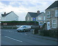
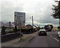
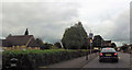
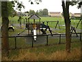
BA3 4SB is a small residential postcode cluster in Somerset, encompassing the village of Westfield. With a population of 1,875 spread across 1.2 hectares, it is densely populated, reflecting a suburban character shaped by 19th-century miners’ cottages and 1970s housing estates. The area lies along the historic Fosse Way Roman road, between Radstock and Midsomer Norton, blending residential, industrial, and green spaces. Daily life here is defined by proximity to local amenities, with nearby towns offering services and transport links. The parish includes farmland, scrubland, and the overgrown Waterside Valley coal tip, alongside modern housing and trading estates. Westfield’s history as a coal-mining hub is evident in its landmarks, such as the Grade II-listed Westfield House and the Five Arches Greenway, a converted railway path. While the area is compact, its mix of heritage and contemporary living makes it distinct, appealing to those seeking a suburban lifestyle near market towns.
- Area Type
- Postcode
- Area Size
- 1.2 hectares
- Population
- Not available
- Population Density
- Not available
The property market in BA3 4SB is characterised by a high rate of home ownership (79%) and a predominance of houses. This suggests a largely owner-occupied area, with limited rental activity. The housing stock includes 19th- and 20th-century miners’ cottages, as well as 1970s estates, creating a mix of architectural styles. Given the small area size (1.2 hectares) and high population density, properties are likely to be compact, with limited scope for new developments. Buyers in this area may find a focus on established homes rather than speculative investment. The proximity to Radstock and Midsomer Norton offers access to larger towns for additional services, though the immediate surroundings are primarily residential. The market is likely competitive, with demand driven by the area’s affordability compared to nearby urban centres.
House Prices in BA3 4SB
No properties found in this postcode.
Energy Efficiency in BA3 4SB
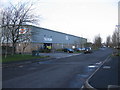
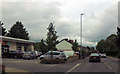
Residents of BA3 4SB have access to nearby retail amenities, including The Radstock Co-operative Society, Sainsburys Midsomer, and other local shops. The area’s industrial legacy is evident in trading estates, but the Five Arches Greenway provides a green space for leisure, cycling, and walking. The village’s character blends historic miners’ cottages with modern housing, creating a mix of architectural styles. While the immediate vicinity offers basic shopping, dining, and recreational options, nearby towns like Radstock and Midsomer Norton provide broader choices. The proximity to farmland and green spaces contrasts with the residential density, offering a balance between urban convenience and natural surroundings. This mix supports a lifestyle that prioritises accessibility to services while retaining elements of rural tranquillity.
Amenities
Schools
Near BA3 4SB are Westfield Primary School, a primary school with an Ofsted rating of ‘good’, and Fosse Way School, a special school. These institutions cater to a range of educational needs, with the primary school serving younger children and the special school providing tailored support for students with specific requirements. The presence of both school types indicates a diverse educational landscape, though no secondary schools are listed. Families with children may benefit from the proximity of these schools, though the lack of a broader range of educational options could be a consideration. The ‘good’ rating at Westfield Primary suggests a reliable local resource, while Fosse Way’s specialisation addresses niche needs.
| Rank | School | Type | Entry gender | Ages |
|---|
Explore more schools in this area
Go to Schools tabDemographics
The population of BA3 4SB has a median age of 47, with the majority aged 30–64 years. Home ownership is high at 79%, indicating a stable, long-term resident base. The accommodation is predominantly houses, reflecting a traditional suburban layout. The predominant ethnic group is White, though specific diversity data is not provided. The area’s demographics suggest a mature community, likely with established families and professionals. The high home ownership rate and age profile imply a focus on settled living rather than transient populations. The population density of 157,069 people per square kilometre is exceptionally high, which may influence local infrastructure and community dynamics. This density, combined with the age distribution, suggests a need for well-maintained public services and amenities to support the demographic profile.
Household Size
Accommodation Type
Tenure
Ethnic Group
Religion
Household Composition
Age
Household Deprivation
NS-SEC
Explore more demographic insights in this area
Go to Demographics tabPlanning
Planning Constraints
- Flood RiskPremium
- Ramsar Wetland SitesPremium
- Area of Outstanding Natural BeautyPremium
- Protected Nature ReservePremium
- Protected WoodlandPremium