Area Overview for BA3 3JZ
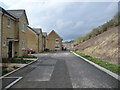
Photos of BA3 3JZ
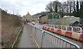
![Track on the former Great Western Railway [Radstock Branch] in BA3 3JZ](https://images.propbar.co.uk/images/geograph/57/56/5756755_120.jpg)
33 photos from this area
Area Information
Key information about the BA3 3JZ including its size, population, and administrative classification.
- Area Type
- Postcode
- Area Size
- 2.0 hectares
- Population
- 1464
- Population Density
- 1923 people/km²
House Prices in BA3 3JZ
20
Properties
£310,236
Average Sold Price
£112,000
Lowest Price
£492,500
Highest Price
Showing 20 properties
| Address | Type | Beds | Baths | Last Sale Price | Last Sale Date | |
|---|---|---|---|---|---|---|
| Laurels, Frome Road, Radstock, BA3 3JZ | house | 3 | 2 | £350,000 | Jul 2025 | |
| 35 Frome Road, Radstock, BA3 3JZ | house | 3 | - | £490,000 | Feb 2025 | |
| 23 Frome Road, Radstock, BA3 3JZ | Bungalow | 3 | 2 | £412,500 | Feb 2025 | |
| The Conifers, 29 Frome Road, Radstock, BA3 3JZ | Detached | 4 | 1 | £492,500 | Jun 2022 | |
| 27 Frome Road, Radstock, BA3 3JZ | house | - | - | £410,000 | Dec 2020 | |
| Sunbays, Frome Road, Radstock, BA3 3JZ | house | - | - | £432,000 | Aug 2020 | |
| St Ronans, Frome Road, Radstock, BA3 3JZ | house | - | - | £250,000 | Mar 2020 | |
| Ael Y Bryn, Frome Road, Radstock, BA3 3JZ | house | - | - | £250,000 | Oct 2019 | |
| Maracaibo, Frome Road, Radstock, BA3 3JZ | Detached | 3 | 1 | £322,500 | May 2018 | |
| 33 Frome Road, Radstock, BA3 3JZ | Detached | 4 | - | £375,000 | Apr 2017 |
Page 1 of 2
Energy Efficiency in BA3 3JZ
Amenities
Schools
| Rank | School | Type | Entry gender | Ages |
|---|
Explore more schools in this area
Go to Schools tabDemographics
Household Size
Family (3-5 people)
most common
Accommodation Type
Houses
most common
Tenure
78
majority
Ethnic Group
White
most common
Religion
N/A
most common
Household Composition
N/A
most common
Age
47
median
Adults (30-64 years)
most common
Household Deprivation
N/A
with no deprivation
NS-SEC
29
in Lower managerial occupations
Explore more demographic insights in this area
Go to Demographics tabPlanning
Planning Constraints
- Flood RiskPremium
- Ramsar Wetland SitesPremium
- Area of Outstanding Natural BeautyPremium
- Protected Nature ReservePremium
- Protected WoodlandPremium