Area Overview for BA3 3AL
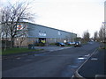
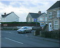
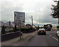
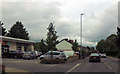
Photos of BA3 3AL

Area Information
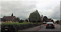
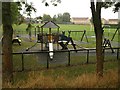
Living in BA3 3AL means inhabiting a small, densely populated residential cluster in the civil parish of Westfield, Somerset. The area covers 8,924 square metres, with a population of 1,875 people, resulting in a high population density of 210,101 people per square kilometre. This compact community sits along the historic Fosse Way Roman road, a route that once connected Radstock and Midsomer Norton. The area’s character is shaped by its 19th-century miners’ cottages, 1970s housing estates, and pockets of industrial land. Daily life here is defined by proximity to nearby towns like Radstock and Midsomer Norton, which offer essential services. The village’s history as a coal-mining hub is still visible in landmarks such as the disused Norton Hill colliery and the Five Arches Greenway, a former railway line repurposed for cycling. BA3 3AL is a quiet suburbia, where residential and industrial elements coexist, and the landscape blends farmland with overgrown coal tips. For those seeking a compact, historically rooted community with easy access to nearby amenities, this area offers a distinct blend of old and new.
- Area Type
- Postcode
- Area Size
- 8924 m²
- Population
- Not available
- Population Density
- Not available
The property market in BA3 3AL is dominated by owner-occupied homes, with 79% of households owning their properties. This high rate of home ownership reflects a stable, long-term resident base rather than a rental market. The predominant accommodation type is houses, which are typically found in the 19th-century miners’ cottages and 1970s housing estates that define the area. Given the small size of the postcode area, the housing stock is limited, and buyers may need to consider nearby suburbs like Radstock or Midsomer Norton for more options. The mix of older and newer properties suggests a range of price points, though specific data on property values is absent. For buyers, the area’s compact size and historical character offer a unique appeal, though the lack of major transport links or commercial hubs may require proximity to nearby towns for employment or shopping.
House Prices in BA3 3AL
Showing 1 properties
| Address | Type | Beds | Baths | Last Sale Price | Last Sale Date | |
|---|---|---|---|---|---|---|
| Fosseway School, Longfellow Road, Westfield, BA3 3AL | education | - | - | - | - |
Energy Efficiency in BA3 3AL
Residents of BA3 3AL have access to a modest selection of amenities within practical reach. The nearby retail category includes five venues, with notable examples such as The Radstock Co-operative Society Co and Lidl Thicket. These shops provide basic grocery and retail needs, though the area lacks large supermarkets or high-street chains. The village’s character is shaped by its mix of residential, industrial, and green spaces, including the Five Arches Greenway, a cycling path repurposed from a former railway. While there are no named parks or leisure facilities in the data, the surrounding farmland and scrubland offer informal outdoor spaces. The presence of industrial areas and trading estates suggests a practical, working-class lifestyle, with daily life centered on nearby towns for more extensive shopping, dining, and cultural activities. The compact nature of BA3 3AL means residents must balance convenience with the need to travel for broader amenities.
Amenities
Schools
The schools nearest to BA3 3AL include Westfield Primary School, a primary school with a ‘good’ Ofsted rating, and Fosse Way School, a special needs school listed twice in the data. Westfield Primary School provides education for younger children, while Fosse Way School caters to students with special educational needs. The presence of both a primary and a special school suggests a range of educational options for families, though the absence of secondary schools means students may need to travel to Radstock or Midsomer Norton for further education. The ‘good’ rating at Westfield Primary indicates a reliable local school, but parents with children requiring special education will find Fosse Way School a critical resource. The mix of school types reflects the area’s demographic focus on families with children, though the limited school infrastructure underscores the need for nearby towns to supplement the local offering.
| Rank | School | Type | Entry gender | Ages |
|---|
Explore more schools in this area
Go to Schools tabDemographics
The residents of BA3 3AL have a median age of 47, with the majority falling in the 30–64 age range. This suggests a community skewed towards middle-aged adults, likely including families and long-term residents. Home ownership is high at 79%, indicating a stable, settled population. The predominant accommodation type is houses, reflecting a suburban rather than a high-density urban setting. The predominant ethnic group is White, though no further breakdown of diversity is provided. The area’s demographics align with its history as a working-class settlement, with housing stock reflecting both 19th-century miners’ cottages and 1970s developments. The high home ownership rate and age profile suggest a community with limited turnover, where residents are likely to stay long-term. This stability is reinforced by the absence of major planning constraints, such as protected nature reserves or Areas of Outstanding Natural Beauty, which might otherwise influence housing trends.
Household Size
Accommodation Type
Tenure
Ethnic Group
Religion
Household Composition
Age
Household Deprivation
NS-SEC
Explore more demographic insights in this area
Go to Demographics tabPlanning
Planning Constraints
- Flood RiskPremium
- Ramsar Wetland SitesPremium
- Area of Outstanding Natural BeautyPremium
- Protected Nature ReservePremium
- Protected WoodlandPremium