Area Overview for BA3 2WA
Photos of BA3 2WA

Area Information
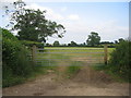
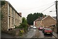
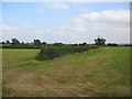
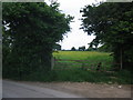
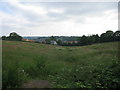
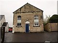
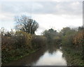
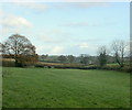
BA3 2WA is a small, densely populated residential postcode in the heart of Midsomer Norton, Somerset. With 1,486 residents packed into 948 people per square kilometre, this area reflects a compact, close-knit community. Its history dates back over a millennium, shaped by medieval markets, 19th-century coal mining, and the legacy of the Somerset & Dorset Railway. Today, the area’s character is defined by its proximity to natural features like the River Somer and Wellow Brook, and its position as part of the Norton Radstock conurbation, a historic transport hub. Living here means navigating a mix of historical charm and modern practicality. The median age of 47 suggests a stable population of adults, many of whom own their homes. While the area lacks large-scale amenities, its small size fosters a sense of familiarity, with local shops and schools within easy reach. For those seeking a quiet, low-density lifestyle, BA3 2WA offers a snapshot of rural England’s enduring appeal, tempered by the realities of its limited space and historical infrastructure.
- Area Type
- Postcode
- Area Size
- Not available
- Population
- 1486
- Population Density
- 948 people/km²
The property market in BA3 2WA is dominated by owner-occupied homes, with 70% of residents living in properties they own. This contrasts with rental markets, where buy-to-let or private rentals are more common. The accommodation type is exclusively houses, with no mention of flats or apartments, indicating a traditional, low-density housing stock. This structure is typical of rural and semi-rural areas, where larger properties are more prevalent. However, the small size of BA3 2WA, combined with its high population density, suggests that housing availability may be limited within the postcode itself. Buyers considering the area should look beyond BA3 2WA to the broader Norton Radstock conurbation, where historical transport links and industrial heritage might offer more options. The focus on owner-occupation also implies that the market is less influenced by short-term rental demand, potentially offering long-term value for those seeking stability in a compact, established community.
House Prices in BA3 2WA
No properties found in this postcode.
Energy Efficiency in BA3 2WA
Residents of BA3 2WA have access to five retail venues within practical reach, including Lidl Thicket, Sainsburys Midsomer, and Asda Norton. These stores provide essential shopping, grocery, and retail services, supporting daily life in the area. While the data does not specify dining or leisure options, the presence of multiple supermarkets suggests a basic level of convenience for households. The area’s historical character, including landmarks like the 15th-century Tithe Barn and Italianate Gothic Town Hall, adds a layer of cultural richness to everyday life. However, the absence of detailed information on parks, recreational facilities, or entertainment venues means that residents may need to travel to nearby towns for more diverse leisure opportunities. The compact nature of BA3 2WA, combined with its retail options, creates a functional but limited lifestyle, where practicality often takes precedence over expansive amenities.
Amenities
Schools
The nearest school to BA3 2WA is Welton Primary School, a primary institution with an Ofsted rating of ‘good’. This rating indicates that the school meets national standards in teaching quality, pupil outcomes, and leadership. As a primary school, it serves the needs of younger children in the area, though the data does not mention secondary education options. The presence of a ‘good’-rated primary school is a key consideration for families, offering a foundation for early education. However, the absence of secondary schools or other educational institutions within the postcode means that students may need to travel to nearby towns for higher education. The school’s rating suggests a reliable local resource, but the limited range of educational facilities could be a drawback for families requiring a full spectrum of schooling options.
| Rank | School | Type | Entry gender | Ages |
|---|
Explore more schools in this area
Go to Schools tabDemographics
The community in BA3 2WA is predominantly composed of adults aged 30–64, with a median age of 47. This suggests a population skewed towards middle-aged and older residents, many of whom are likely to be long-term residents. Home ownership is high, at 70%, indicating a stable, settled demographic. The area is characterised by houses rather than flats or apartments, reflecting a traditional, family-oriented housing stock. The predominant ethnic group is White, with no specific data provided on other demographics. The high population density of 948 people per square kilometre, combined with the age profile, points to a community where families and older adults coexist in a compact setting. While the data does not specify deprivation levels, the high home ownership and age distribution suggest a relatively secure, low-turnover population. This stability may contribute to a cohesive, familiar social environment, though the area’s small size could limit opportunities for younger residents or those seeking more dynamic urban amenities.
Household Size
Accommodation Type
Tenure
Ethnic Group
Religion
Household Composition
Age
Household Deprivation
NS-SEC
Explore more demographic insights in this area
Go to Demographics tabPlanning
Planning Constraints
- Flood RiskPremium
- Ramsar Wetland SitesPremium
- Area of Outstanding Natural BeautyPremium
- Protected Nature ReservePremium
- Protected WoodlandPremium