Area Overview for BA3 2AJ
Photos of BA3 2AJ
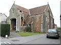
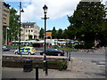
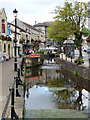
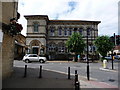


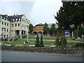

73 photos from this area
Area Information
Key information about the BA3 2AJ including its size, population, and administrative classification.
- Area Type
- Postcode
- Area Size
- 1.0 hectares
- Population
- 1486
- Population Density
- 948 people/km²
House Prices in BA3 2AJ
30
Properties
£192,650
Average Sold Price
£38,000
Lowest Price
£680,000
Highest Price
Showing 30 properties
| Address | Type | Beds | Baths | Last Sale Price | Last Sale Date | |
|---|---|---|---|---|---|---|
| 2 Radstock Road, Midsomer Norton, BA3 2AJ | Terraced | 3 | 1 | £230,000 | Feb 2025 | |
| 9 Radstock Road, Midsomer Norton, BA3 2AJ | Terraced | 2 | 1 | £215,000 | Jan 2025 | |
| 21 Radstock Road, Midsomer Norton, BA3 2AJ | house | - | - | £140,000 | Aug 2023 | |
| 23 Radstock Road, Midsomer Norton, BA3 2AJ | Terraced | 3 | 1 | £187,000 | May 2022 | |
| 6 Radstock Road, Midsomer Norton, BA3 2AJ | house | 4 | - | £680,000 | Mar 2022 | |
| 15 Radstock Road, Midsomer Norton, BA3 2AJ | house | - | - | £197,500 | Feb 2022 | |
| 12 Radstock Road, Midsomer Norton, BA3 2AJ | Terraced | 2 | 1 | £185,000 | Oct 2021 | |
| 13 Radstock Road, Midsomer Norton, BA3 2AJ | house | - | - | £195,000 | Oct 2021 | |
| 11 Radstock Road, Midsomer Norton, BA3 2AJ | Terraced | - | - | £170,000 | Jul 2018 | |
| 17 Radstock Road, Midsomer Norton, BA3 2AJ | Terraced | 2 | 1 | £184,000 | Jul 2018 |
Page 1 of 3
Energy Efficiency in BA3 2AJ
Amenities
Schools
| Rank | School | Type | Entry gender | Ages |
|---|
Explore more schools in this area
Go to Schools tabDemographics
Household Size
One person
most common
Accommodation Type
Houses
most common
Tenure
70
majority
Ethnic Group
White
most common
Religion
N/A
most common
Household Composition
N/A
most common
Age
47
median
Adults (30-64 years)
most common
Household Deprivation
N/A
with no deprivation
NS-SEC
27
in Lower managerial occupations
Explore more demographic insights in this area
Go to Demographics tabPlanning
Planning Constraints
- Flood RiskPremium
- Ramsar Wetland SitesPremium
- Area of Outstanding Natural BeautyPremium
- Protected Nature ReservePremium
- Protected WoodlandPremium