Area Overview for BA22 9UR
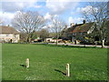
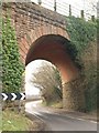
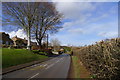
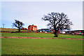
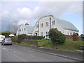
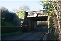
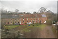
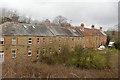
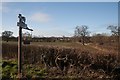
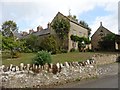
Photos of BA22 9UR


Area Information
Living in BA22 9UR defines a specific residential experience within a compact footprint. This postcode covers a precise 1.3 hectares and contains a population of 1,095 residents. You navigate a neighbourhood shaped by its small scale, which fosters a tight community feel. The density reaches 806 people per square kilometre, indicating a clustered living environment rather than sprawling development. This area operates as a small residential cluster where daily routines are shaped by proximity to local hubs. The setting in England offers a distinct pace of life, balancing the convenience of nearby facilities with the quiet of a limited-concentration zone. You find yourself in a location where every household is part of the immediate fabric of the neighbourhood. The character here is defined by its residential nature and its separation from major industrial zones. Your homes sit within a defined boundary, offering a sense of enclosure. This environment suits those who prefer a settled lifestyle over rapid urban expansion. The specific postcode acts as a gateway to a well-defined slice of the wider region. Your daily commute and leisure activities stem from this centralised location. The area maintains its identity as a cohesive unit for all 1,095 souls calling it home.
- Area Type
- Postcode
- Area Size
- 1.3 hectares
- Population
- 1095
- Population Density
- 806 people/km²
The housing stock in BA22 9UR is characterised by a strong preference for ownership. Sixty-two per cent of homes fall into the owner-occupied category. This majority signals that the market is driven by residents who have invested in their properties. Houses make up the predominant accommodation type you will encounter when surveying the area. You will find very few flats or apartments within these boundaries. This configuration creates a traditional suburban or rural residential feel rather than a high-density urban environment. When you consider buying in this postcode, you are looking for a standalone home or a property within a small cluster of similar dwellings. The low density of 806 people per square kilometre reinforces the space available between properties. Investment potential here connects closely with the stability of a large owner-occupier base. You face less competition from the private rental sector compared to larger cities. Your focus shifts to the long-term value of a house in a mature neighbourhood. The market here rewards those seeking stability over rapid turnover. Prices reflect the cost of acquiring an asset rather than a temporary lease. The 1.3-hectare limit ensures that property values remain influenced by a contained local supply.
House Prices in BA22 9UR
Showing 11 properties
| Address | Type | Beds | Baths | Last Sale Price | Last Sale Date | |
|---|---|---|---|---|---|---|
| 2, Quarry Cottages, Newton Road, Stoford, Yeovil, BA22 9UR | Terraced | 3 | 2 | £235,000 | Jan 2025 | |
| 11, Quarry Cottages, Newton Road, Stoford, Yeovil, BA22 9UR | Terraced | 2 | 1 | £200,000 | Aug 2022 | |
| 7, Quarry Cottages, Newton Road, Stoford, Yeovil, BA22 9UR | house | 3 | 1 | £165,000 | Jul 2016 | |
| 9, Quarry Cottages, Newton Road, Stoford, Yeovil, BA22 9UR | Terraced | 3 | - | £145,500 | Apr 2016 | |
| 6, Quarry Cottages, Newton Road, Stoford, Yeovil, BA22 9UR | Terraced | 3 | - | £155,000 | Mar 2015 | |
| 1, Quarry Cottages, Newton Road, Stoford, Yeovil, BA22 9UR | Terraced | 2 | 1 | £115,000 | Feb 2014 | |
| 3, Quarry Cottages, Newton Road, Stoford, Yeovil, BA22 9UR | Terraced | 2 | 1 | £119,000 | May 2006 | |
| 10, Quarry Cottages, Newton Road, Stoford, Yeovil, BA22 9UR | house | - | - | £140,000 | Dec 2005 | |
| 5, Quarry Cottages, Newton Road, Stoford, Yeovil, BA22 9UR | Terraced | - | - | £143,000 | Nov 2005 | |
| 8, Quarry Cottages, Newton Road, Stoford, Yeovil, BA22 9UR | house | 3 | 2 | £64,000 | Aug 2000 |
Energy Efficiency in BA22 9UR
Your daily life in BA22 9UR gains convenience from a range of nearby amenities. Travelers rely on five railway stations within reach, including Yeovil Junction Railway Station, Yeovil Pen Mill Railway Station, and Thornford Railway Station. These rails connect you to broader networks for business or leisure trips. Shopping needs are met by five retail outlets shortly outside your postcode. Iceland Yeovil FWH, Asda Yeovil, and Farmfoods Yeovil offer essential groceries and household goods. You can fill your weekly shop quickly without undertaking a long journey. Aviation interests are served by RNAS Yeovilton, located nearby and accessible for residents interested in that sector. These amenities create a practical hub within commuting distance. Dining options are embedded within the retail sector, ensuring meals are available nearby. The mix of rail, retail, and industrial proximity provides versatility in your daily routes. You spend less time traveling and more time at home or enjoying leisure activities. The convenience of these specific names into your transport and shopping plans defines the lifestyle here.
Amenities
Schools
Education options for families in BA22 9UR centre on one specific primary institution. Barwick and Stoford Community Primary School serves as the nearest educational facility. This school holds an Ofsted rating of satisfactory, indicating a baseline standard of education for students. You have access to primary education without needing to travel further afield for basic schooling. The absence of secondary schools within the immediate data means older children may require travel for high school education. This satellite arrangement means families must plan transport logistics for teenagers. The single primary option suggests a community focused on local attendance for younger pupils. You can expect a school environment that is closely integrated with the immediate neighbourhood. The satisfactory rating provides reassurance that the institution meets regulatory requirements. Educational diversity is limited by the data available, pointing to a specialised catchment area. Your children will attend Barwick and Stoford Community Primary School for their early years. This concentration of educational provision creates a predictable routine for parents in the area.
| Rank | School | Type | Entry gender | Ages |
|---|
Explore more schools in this area
Go to Schools tabDemographics
The community in BA22 9UR reflects a mature and stable demographic profile. Adults aged between 30 and 64 years represent the most common age range. The median age stands at 47, confirming that the neighbourhood attracts families and established individuals. This age distribution suggests you are joining an area where life has already taken root. Home ownership levels sit at 62 per cent, meaning the majority of residents have purchased their properties. This figure highlights a market dominated by owner-occupiers rather than landlords or long-term tenants. Historically, the area has been built primarily for houses, creating a consistent architectural rhythm. The predominant ethnic group is White, contributing to a culturally consistent environment for new arrivals. These statistics paint a picture of a settled, middle-aged population with strong ties to their homes. Deprivation data is not provided in the current records, yet the high ownership rate and stable age profile suggest economic consistency. You are entering a community where financial independence is common and family structures are prominent. The lack of significant younger demographic skew means schools nearby cater more to established family needs. Your neighbours are likely to share similar life stages and priorities regarding property maintenance and local stability.
Household Size
Accommodation Type
Tenure
Ethnic Group
Religion
Household Composition
Age
Household Deprivation
NS-SEC
Explore more demographic insights in this area
Go to Demographics tabPlanning
Planning Constraints
- Flood RiskPremium
- Ramsar Wetland SitesPremium
- Area of Outstanding Natural BeautyPremium
- Protected Nature ReservePremium
- Protected WoodlandPremium