Area Overview for BA22 9UE
Photos of BA22 9UE
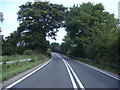
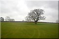
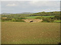
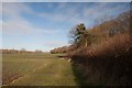
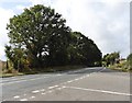
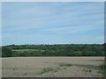
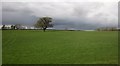
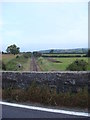
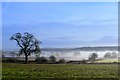

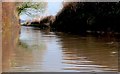
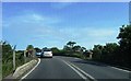
16 photos from this area
Area Information
Key information about the BA22 9UE including its size, population, and administrative classification.
- Area Type
- Postcode
- Area Size
- 30.7 hectares
- Population
- 1095
- Population Density
- 806 people/km²
House Prices in BA22 9UE
24
Properties
£171,194
Average Sold Price
£48,250
Lowest Price
£271,000
Highest Price
Showing 24 properties
| Address | Type | Beds | Baths | Last Sale Price | Last Sale Date | |
|---|---|---|---|---|---|---|
| 18 Hoopers Lane, Barwick, Yeovil, BA22 9UE | Terraced | 2 | 1 | £195,000 | Mar 2025 | |
| 16 Hoopers Lane, Barwick, Yeovil, BA22 9UE | Terraced | 2 | 1 | £210,000 | Jun 2024 | |
| 12 Hoopers Lane, Barwick, Yeovil, BA22 9UE | Terraced | 3 | 1 | £202,000 | Dec 2022 | |
| Brook View, 5 Hoopers Lane, Barwick, Yeovil, BA22 9UE | house | 3 | 1 | £271,000 | Dec 2022 | |
| 8 Hoopers Lane, Barwick, Yeovil, BA22 9UE | Retail | 3 | 1 | £240,000 | Sep 2022 | |
| 20 Hoopers Lane, Barwick, Yeovil, BA22 9UE | Terraced | 2 | - | £122,000 | Jun 2015 | |
| 14 Hoopers Lane, Barwick, Yeovil, BA22 9UE | Terraced | 2 | 1 | £127,500 | Mar 2015 | |
| 10 Hoopers Lane, Barwick, Yeovil, BA22 9UE | Terraced | 3 | 1 | £125,000 | Mar 2005 | |
| 6 Hoopers Lane, Barwick, Yeovil, BA22 9UE | Terraced | - | - | £48,250 | Aug 1996 | |
| Flat 1, Hoopers Court, Hoopers Lane, Barwick, Yeovil, BA22 9UE | Flat | 1 | 1 | - | - |
Page 1 of 3
Energy Efficiency in BA22 9UE
Amenities
Schools
| Rank | School | Type | Entry gender | Ages |
|---|
Explore more schools in this area
Go to Schools tabDemographics
Household Size
Two person
most common
Accommodation Type
Houses
most common
Tenure
62
majority
Ethnic Group
White
most common
Religion
N/A
most common
Household Composition
N/A
most common
Age
47
median
Adults (30-64 years)
most common
Household Deprivation
N/A
with no deprivation
NS-SEC
26
in Lower managerial occupations
Explore more demographic insights in this area
Go to Demographics tabPlanning
Planning Constraints
- Flood RiskPremium
- Ramsar Wetland SitesPremium
- Area of Outstanding Natural BeautyPremium
- Protected Nature ReservePremium
- Protected WoodlandPremium