Area Overview for BA22 9TE
Photos of BA22 9TE
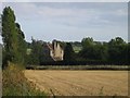
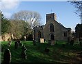
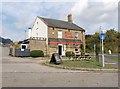
25 photos from this area
Area Information
Key information about the BA22 9TE including its size, population, and administrative classification.
- Area Type
- Postcode
- Area Size
- 18.5 hectares
- Population
- 1546
- Population Density
- 135 people/km²
House Prices in BA22 9TE
23
Properties
£350,071
Average Sold Price
£120,000
Lowest Price
£572,500
Highest Price
Showing 23 properties
| Address | Type | Beds | Baths | Last Sale Price | Last Sale Date | |
|---|---|---|---|---|---|---|
| Willow Cottage, Church Lane, Barwick, Yeovil, BA22 9TE | Flat | 1 | 1 | £572,500 | Dec 2020 | |
| Park Cottage, Church Lane, Barwick, Yeovil, BA22 9TE | house | 3 | 1 | £360,000 | Aug 2016 | |
| Old Orchard, Church Lane, Barwick, Yeovil, BA22 9TE | Bungalow | 3 | - | £280,000 | Aug 2016 | |
| Blair House, Church Lane, Barwick, Yeovil, BA22 9TE | Detached | 4 | 2 | £279,000 | Sep 2013 | |
| Church Farm House, Church Lane, Barwick, Yeovil, BA22 9TE | Detached | - | - | £525,000 | Oct 2009 | |
| Wisteria House, Church Lane, Barwick, Yeovil, BA22 9TE | Detached | 4 | 2 | £314,000 | Apr 2009 | |
| Church Farm Bungalow, Church Lane, Barwick, Yeovil, BA22 9TE | Detached | - | - | £120,000 | Aug 1998 | |
| Sharlands, Church Lane, Barwick, Yeovil, BA22 9TE | Detached | 5 | 3 | - | - | |
| Wychwood, Church Lane, Barwick, Yeovil, BA22 9TE | Detached | 4 | 2 | - | - | |
| Moonlighting, Church Lane, Barwick, Yeovil, BA22 9TE | Terraced | 3 | - | - | - |
Page 1 of 3
Energy Efficiency in BA22 9TE
Amenities
Schools
| Rank | School | Type | Entry gender | Ages |
|---|
Explore more schools in this area
Go to Schools tabDemographics
Household Size
Two person
most common
Accommodation Type
Houses
most common
Tenure
84
majority
Ethnic Group
White
most common
Religion
N/A
most common
Household Composition
N/A
most common
Age
47
median
Adults (30-64 years)
most common
Household Deprivation
N/A
with no deprivation
NS-SEC
42
in Lower managerial occupations
Explore more demographic insights in this area
Go to Demographics tabPlanning
Planning Constraints
- Flood RiskPremium
- Ramsar Wetland SitesPremium
- Area of Outstanding Natural BeautyPremium
- Protected Nature ReservePremium
- Protected WoodlandPremium