Area Overview for BA22 9RR
Photos of BA22 9RR
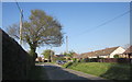
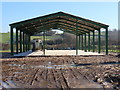
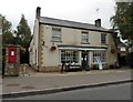
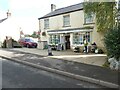
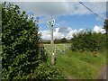
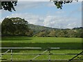

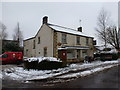
16 photos from this area
Area Information
Key information about the BA22 9RR including its size, population, and administrative classification.
- Area Type
- Postcode
- Area Size
- 54.2 hectares
- Population
- 1871
- Population Density
- 25 people/km²
House Prices in BA22 9RR
11
Properties
£502,250
Average Sold Price
£143,500
Lowest Price
£925,000
Highest Price
Showing 11 properties
| Address | Type | Beds | Baths | Last Sale Price | Last Sale Date | |
|---|---|---|---|---|---|---|
| Stone Cottage, Yeovil Road, Halstock, BA22 9RR | Bungalow | 3 | 1 | £590,000 | Dec 2022 | |
| Clematis Cottage, Yeovil Road, Halstock, BA22 9RR | house | - | - | £925,000 | Nov 2021 | |
| Greenlea, Yeovil Road, Halstock, BA22 9RR | Bungalow | - | - | £450,000 | May 2021 | |
| Staddlestones, Yeovil Road, Halstock, BA22 9RR | house | 4 | - | £520,000 | Nov 2011 | |
| Long Lydemarsh, Yeovil Road, Halstock, BA22 9RR | Bungalow | - | - | £385,000 | Jul 2002 | |
| Laurel Cottage, Yeovil Road, Halstock, BA22 9RR | Detached | - | - | £143,500 | Apr 2002 | |
| Caravan, Halstock Nursery, Yeovil Road, Halstock, BA22 9RR | Mobile Home | - | - | - | - | |
| Dorset Water Lillies, Yeovil Road, Halstock, BA22 9RR | Farm | - | - | - | - | |
| Sunnymead Farm, Yeovil Road, Halstock, BA22 9RR | Detached | - | - | - | - | |
| Hazelmead, Yeovil Road, Halstock, BA22 9RR | Detached | - | - | - | - |
Page 1 of 2
Energy Efficiency in BA22 9RR
Amenities
Schools
| Rank | School | Type | Entry gender | Ages |
|---|
Explore more schools in this area
Go to Schools tabDemographics
Household Size
Two person
most common
Accommodation Type
Houses
most common
Tenure
67
majority
Ethnic Group
White
most common
Religion
N/A
most common
Household Composition
N/A
most common
Age
47
median
Adults (30-64 years)
most common
Household Deprivation
N/A
with no deprivation
NS-SEC
38
in Lower managerial occupations
Explore more demographic insights in this area
Go to Demographics tabPlanning
Planning Constraints
- Flood RiskPremium
- Ramsar Wetland SitesPremium
- Area of Outstanding Natural BeautyPremium
- Protected Nature ReservePremium
- Protected WoodlandPremium