Area Overview for BA22 9PR
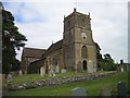
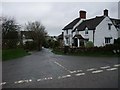
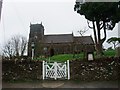
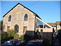
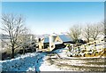
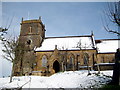
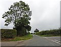
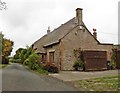
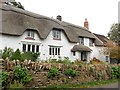
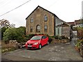
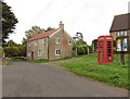
Photos of BA22 9PR

Area Information
BA22 9PR represents a specific residential cluster in Yeovil with a total footprint of 8513 m². You will find this postcode area serves a population of 1474 residents, creating a small but established local community. The low population density of 54 people per km² means streets remain quiet and the environment feels spacious rather than crowded. This area functions as a compact residential pocket where neighbours likely know one another. Daily life here revolves around the immediate locality, avoiding the congestion often found in denser urban centres. Because the area is so small, access to local services requires a short drive or a walk to nearby towns like Yeovil. The layout suggests a suburb designed for car use, with easy links to the wider county network. You can expect a stable environment where the focus remains on home ownership and family living rather than transient housing. The compact nature of BA22 9PR ensures that what you see in daily life is representative of the whole community. There are no hidden large estates or sudden industrial zones breaking the residential character within this specific postcode boundary. Instead, it offers a consistent, manageable setting for those seeking a settled life in Somerset.
- Area Type
- Postcode
- Area Size
- 8513 m²
- Population
- 1474
- Population Density
- 54 people/km²
Homes in BA22 9PR are characterised by a strong owner-occupation culture where 72% of properties are owned by their occupants. This statistic signals a market driven by established families rather than short-term renters or property speculators. You will primarily find houses as the predominant form of accommodation, with no reported presence of flats or apartments within this specific cluster. This housing mix supports a lifestyle centred on family living and long-term settlement. The low volume of 1474 residents across 8513 m² suggests a limited but dedicated stock of properties. Buyers looking for entry-level homes may find this area accessible, while upgraders might explore the immediate surroundings of BA22 9PR. The absence of a significant rental market means investment opportunities focus on occupancy stability rather than yield volatility. When you view a home here, you are likely dealing with remains of original owners rather than institutional landlords. This creates a purchasing environment where neighbours often tolerate maintenance notes and minor quirks that a high-turnover rental block would not accept. The market reflects the area's status as a quiet, buy-to-own community deeply embedded in local history.
House Prices in BA22 9PR
Showing 12 properties
| Address | Type | Beds | Baths | Last Sale Price | Last Sale Date | |
|---|---|---|---|---|---|---|
| Autumn House, Broadstone Lane, Hardington Mandeville, Yeovil, BA22 9PR | house | 3 | - | £390,000 | Apr 2013 | |
| Cherry Tree House, Broadstone Lane, Hardington Mandeville, Yeovil, BA22 9PR | house | - | - | £420,000 | Aug 2012 | |
| 332 Broadstone Lane, Hardington Mandeville, Yeovil, BA22 9PR | Unknown | - | - | £212,500 | Aug 2005 | |
| Hinton House, Broadstone Lane, Hardington Mandeville, Yeovil, BA22 9PR | Detached | 4 | 2 | - | - | |
| Broadstone House, Broadstone Lane, Hardington Mandeville, Yeovil, BA22 9PR | Detached | 4 | 4 | - | - | |
| Ferndale, Broadstone Lane, Hardington Mandeville, Yeovil, BA22 9PR | Detached | 4 | 4 | - | - | |
| Chestnut House, Broadstone Lane, Hardington Mandeville, Yeovil, BA22 9PR | Detached | 4 | 4 | - | - | |
| Pine Barton, Broadstone Lane, Hardington Mandeville, Yeovil, BA22 9PR | Detached | 3 | 1 | - | - | |
| Tall Elms, Broadstone Lane, Hardington Mandeville, Yeovil, BA22 9PR | house | - | - | - | - | |
| Mulberry Cottage, Broadstone Lane, Hardington Mandeville, Yeovil, BA22 9PR | Semi-detached | - | - | - | - |
Energy Efficiency in BA22 9PR
Living in BA22 9PR places you within practical reach of essential retail and rail links, making daily life convenient without a long commute. You have five retail options nearby, including M&S West Yeovil BP, Spar, and Asda Yeovil for your weekly shopping needs. These stores are located in the nearest commercial clusters and offer everything from food to household essentials. For commuting, rail connectivity remains excellent with five stations within easy reach. Yeovil Junction Railway Station and Yeovil Pen Mill Railway Station provide direct links to Bath and London. Crewkerne Railway Station offers connections to Exeter and hơn the rest of the South West. From these hubs, you can access major cities or pick up friends arriving from farther afield. The combination of supermarkets and railway stations means you can handle work, family, and leisure needs efficiently. You do not need to travel far to restock food supplies or catch a train to the coast. The layout of BA22 9PR ensures that these amenities are always within a short drive or train ride.
Amenities
Schools
| Rank | School | Type | Entry gender | Ages |
|---|
Explore more schools in this area
Go to Schools tabDemographics
The community within BA22 9PR is defined by a mature resident base with a median age of 47 years. Most households consist of adults between 30 and 64 years old, indicating a family-oriented neighbourhood where children and school-aged children are common. Home ownership stands at a solid 72%, meaning the vast majority of residents own their homes outright or have a mortgage. This high ownership rate contrasts sharply with rental hotspots elsewhere in the region. The accommodation type is exclusively houses, confirming that flats or apartments are not a feature of this specific postcode. You will find traditional British housing stock rather than modern high-density blocks. The predominant ethnic group is White, reflecting the typical demographic profile of established rural towns in the South West. This area does not cater to seasonal migration or student housing markets. Instead, it attracts long-term residents who have chosen this location for stability. The demographic profile suggests a quiet life focused on local schools and community events rather than nightlife or tourism. Families with schools-aged children will find this age skew particularly relevant to their needs.
Household Size
Accommodation Type
Tenure
Ethnic Group
Religion
Household Composition
Age
Household Deprivation
NS-SEC
Explore more demographic insights in this area
Go to Demographics tabPlanning
Planning Constraints
- Flood RiskPremium
- Ramsar Wetland SitesPremium
- Area of Outstanding Natural BeautyPremium
- Protected Nature ReservePremium
- Protected WoodlandPremium