Area Overview for BA22 8PN
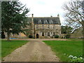
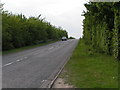
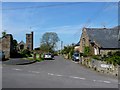
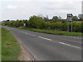
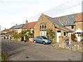
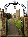
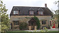
Photos of BA22 8PN
Area Information
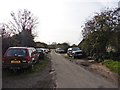
Living in BA22 8PN offers a quiet residential experience defined by its manageable scale. This postcode covers a specific residential cluster spanning 8007 square metres, containing a population of approximately 1200 people. With a density of 78 people per square kilometre, the area feels spacious and uncrowded compared to larger urban settlements. The setting suits those who prefer a slower pace while maintaining access to nearby towns. Residents benefit from a stable community structure where neighbours know each other well without the pressure of high-rising congestion. This small residential pocket sits within the Somerset landscape, providing a serene backdrop for daily life. You will find that daily routines involve easy access to local facilities without the need for long communs through heavy traffic. The layout supports a lifestyle centred on home life, with ample space around your property. The area functions as a true neighbourhood rather than a generic suburb. People here value privacy and enjoy the benefits of low-density living. Your mornings and evenings unfold against a backdrop of established homes rather than commercial noise. This environment appeals to individuals seeking tranquility without complete isolation from the rest of the county. The character of BA22 8PN remains consistent with its role as a small residential cluster. You can walk to many points of interest without navigating complex road networks. The area maintains its identity as a place where community bonds are strong and the streets are familiar. This stability makes it an attractive option for families or couples looking to settle down. Your immediate surroundings provide a sense of security and permanence that rare in rapidly changing parts of the country.
- Area Type
- Postcode
- Area Size
- 8007 m²
- Population
- 1200
- Population Density
- 78 people/km²
The property market in BA22 8PN is distinctly owner-occupied, with 80 per cent of dwellings held by their owners. This statistic defines the area as a stable residential zone rather than a hub for transient tenants. You will find that the majority of homes are held by long-term residents who have chosen to stay. This ownership structure typically results in lower turnover rates and a quieter street life. Homes in BA22 8PN are almost exclusively houses, catering to families and individuals seeking space and privacy. The absence of high-rise blocks or purpose-built flats means the visual character remains consistent with traditional rural living. When you look at the housing stock, you see pitched roofs, gardens, and mature landscaping rather than concrete developments. This uniformity in property type creates a cohesive streetscape that residents take pride in maintaining. For buyers considering this small postcode, the market offers a different experience compared to urban centres. You cannot find new-build apartments on every corner, but you do find established homes with character. The high ownership percentage implies that sellers here are often motivated by specific life changes rather than investor flips. This stability benefits your purchasing power and the long-term value of your investment.
House Prices in BA22 8PN
Showing 3 properties
| Address | Type | Beds | Baths | Last Sale Price | Last Sale Date | |
|---|---|---|---|---|---|---|
| 2 St Margarets Road, Tintinhull, Yeovil, BA22 8PN | Detached | - | - | £319,950 | Aug 2007 | |
| 4 St Margarets Road, Tintinhull, Yeovil, BA22 8PN | Semi-detached | 3 | 2 | £245,000 | Jun 2003 | |
| 6 St Margarets Road, Tintinhull, Yeovil, BA22 8PN | Semi-detached | - | - | - | - |
Energy Efficiency in BA22 8PN
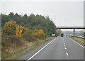
Residents of BA22 8PN enjoy practical access to essential amenities within a short drive. Five retail outlets surround the area, providing convenient shopping options. You can visit the Co-op Stoke sub for everyday essentials or travel to Co-op Martock for slightly more variety. For larger weekly shopping trips, Tesco Yeovil serves the wider community with a full range of goods. The area maintains close links to important infrastructure through its proximity to transport hubs. RNAS Yeovilton operates as the nearest airport, providing access to regional and international travel when needed. The rail network connects you to Yeovil Pen Mill Railway Station and Yeovil Junction Railway Station. These two stations give you flexibility in choosing your travel times and destinations. This combination of retail outlets and transport links creates a balanced lifestyle for families. You can run local errands quickly while still having major services at your fingertips. The presence of a supermarket and high-street retailers means you do not need to travel far for basic needs. Your weekends might involve a trip to Yeovil for dining or leisure activities. The layout supports a life where convenience and nature coexist harmoniously.
Amenities
Schools
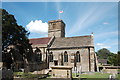
Families living in BA22 8PN have convenient access to two well-regarded primary schools nearby. Chilthorne Domer Church School operates as a primary institution and holds a good Ofsted rating. Similarly, St Margaret's School, Tintinhull also functions as a primary school and carries the same good Ofsted rating. Both schools provide solid educational foundations for children in the catchment area. This mix of primary schools means you can choose between different educational environments while staying close to home. The designation of both schools as "good" indicates that they meet high standards in curriculum delivery and student support. You do not need to commute long distances to secure quality education for your children. The presence of two rated options provides flexibility for parents moving into the area. The absence of secondary schools in the immediate vicinity suggests that older students likely travel to larger towns for their further education. However, the primary options remain robust and reliable for younger learners. School transport arrangements often cover the short distance between BA22 8PN and these educational establishments. Parents appreciate the reliability of these rated institutions when planning their children's future.
| Rank | School | Type | Entry gender | Ages |
|---|
Explore more schools in this area
Go to Schools tabDemographics
The community in BA22 8PN is characterised by a mature population with a median age of 47 years. Most residents fall within the adult age range of 30 to 64 years, indicating a stable demographic focused on family life or established careers. This age profile suggests a neighbourhood where people have put down roots rather than seeking short-term urban living. You will encounter a dynamic mix of parents, retirees, and working professionals who share similar life stages. Home ownership stands at an impressive 80 per cent, creating a strong sense of tenure within the locality. This high ownership rate reflects a community where families have invested in their local properties for the long term. The accommodation type consists primarily of houses, which aligns with the preferences of this age group and the need for space. You will find that the stock is dominated by detached or semi-detached properties rather than apartments. The predominant ethnic group in BA22 8PN is White, mirroring the traditional demographics of the Somerset countryside. This profile contributes to a homogenous community where cultural traditions often run deep. The lack of negative deprivation data in the provided records suggests that the area maintains a reasonable standard of living across households. Residents enjoy peace of mind knowing that the local economy supports their needs. This demographic consistency fosters a predictable environment where neighbours understand one another's circumstances.
Household Size
Accommodation Type
Tenure
Ethnic Group
Religion
Household Composition
Age
Household Deprivation
NS-SEC
Explore more demographic insights in this area
Go to Demographics tabPlanning
Planning Constraints
- Flood RiskPremium
- Ramsar Wetland SitesPremium
- Area of Outstanding Natural BeautyPremium
- Protected Nature ReservePremium
- Protected WoodlandPremium