Area Overview for BA22 8BZ
Photos of BA22 8BZ
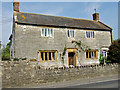
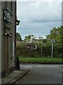
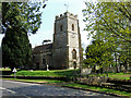
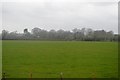
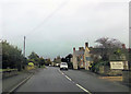
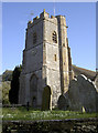
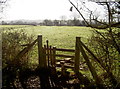
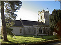
48 photos from this area
Area Information
Key information about the BA22 8BZ including its size, population, and administrative classification.
- Area Type
- Postcode
- Area Size
- 3.8 hectares
- Population
- 1209
- Population Density
- 68 people/km²
House Prices in BA22 8BZ
13
Properties
£544,214
Average Sold Price
£267,000
Lowest Price
£825,000
Highest Price
Showing 13 properties
| Address | Type | Beds | Baths | Last Sale Price | Last Sale Date | |
|---|---|---|---|---|---|---|
| Sandwell, Marston Magna Road, Marston Magna, Yeovil, BA22 8BZ | Detached | 4 | 3 | £825,000 | Aug 2024 | |
| Hunters Lodge, Marston Magna Road, Marston Magna, Yeovil, BA22 8BZ | Detached | 5 | 3 | £770,000 | Nov 2022 | |
| Greenacres, Marston Magna Road, Marston Magna, Yeovil, BA22 8BZ | Detached | 4 | - | £445,000 | Jul 2020 | |
| Old Orchard, Marston Magna Road, Marston Magna, Yeovil, BA22 8BZ | house | - | - | £317,500 | Nov 2017 | |
| Marston Court, Garston Lane, Marston Magna, Yeovil, BA22 8BZ | house | - | - | £750,000 | Dec 2011 | |
| The Old Forge, Marston Magna Road, Marston Magna, Yeovil, BA22 8BZ | Detached | - | - | £267,000 | Jun 2007 | |
| Grey Cedars, Marston Magna Road, Marston Magna, Yeovil, BA22 8BZ | Detached | - | - | £435,000 | Dec 2006 | |
| Dunelm, Marston Magna Road, Marston Magna, Yeovil, BA22 8BZ | Detached | 5 | 3 | - | - | |
| Sandwell, Marston Court, Garston Lane, Marston Magna, Yeovil, BA22 8BZ | Terraced | - | - | - | - | |
| Courtside, Marston Magna Road, Marston Magna, Yeovil, BA22 8BZ | Bungalow | - | - | - | - |
Page 1 of 2
Energy Efficiency in BA22 8BZ
Amenities
Schools
| Rank | School | Type | Entry gender | Ages |
|---|
Explore more schools in this area
Go to Schools tabDemographics
Household Size
Two person
most common
Accommodation Type
Houses
most common
Tenure
82
majority
Ethnic Group
White
most common
Religion
N/A
most common
Household Composition
N/A
most common
Age
47
median
Adults (30-64 years)
most common
Household Deprivation
N/A
with no deprivation
NS-SEC
39
in Lower managerial occupations
Explore more demographic insights in this area
Go to Demographics tabPlanning
Planning Constraints
- Flood RiskPremium
- Ramsar Wetland SitesPremium
- Area of Outstanding Natural BeautyPremium
- Protected Nature ReservePremium
- Protected WoodlandPremium