Area Overview for BA22 7PS
Photos of BA22 7PS
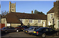
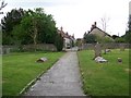
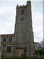
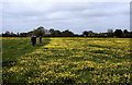
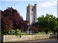
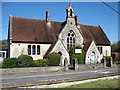
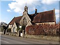
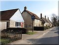
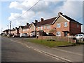
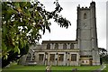
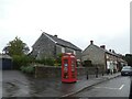
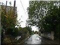
72 photos from this area
Area Information
Key information about the BA22 7PS including its size, population, and administrative classification.
- Area Type
- Postcode
- Area Size
- 8776 m²
- Population
- 1669
- Population Density
- 104 people/km²
House Prices in BA22 7PS
9
Properties
£301,556
Average Sold Price
£225,000
Lowest Price
£420,000
Highest Price
Showing 9 properties
| Address | Type | Beds | Baths | Last Sale Price | Last Sale Date | |
|---|---|---|---|---|---|---|
| 1 Rectory Farm Close, Queen Camel, Yeovil, BA22 7PS | Bungalow | - | - | £375,000 | Jan 2021 | |
| 7 Rectory Farm Close, Queen Camel, Yeovil, BA22 7PS | Bungalow | 3 | 2 | £420,000 | Dec 2019 | |
| 8 Rectory Farm Close, Queen Camel, Yeovil, BA22 7PS | Bungalow | 3 | - | £249,000 | Feb 2017 | |
| 3 Rectory Farm Close, Queen Camel, Yeovil, BA22 7PS | Bungalow | 3 | - | £370,000 | Apr 2016 | |
| 6 Rectory Farm Close, Queen Camel, Yeovil, BA22 7PS | Bungalow | - | - | £295,000 | Sep 2015 | |
| 9 Rectory Farm Close, Queen Camel, Yeovil, BA22 7PS | Bungalow | 3 | - | £270,000 | Apr 2015 | |
| Rosewood, 5 Rectory Farm Close, Queen Camel, Yeovil, BA22 7PS | Bungalow | 3 | - | £275,000 | Dec 2014 | |
| 2 Rectory Farm Close, Queen Camel, Yeovil, BA22 7PS | Bungalow | 3 | - | £235,000 | Mar 2014 | |
| 4 Rectory Farm Close, Queen Camel, Yeovil, BA22 7PS | Detached | - | - | £225,000 | Mar 2009 |
Energy Efficiency in BA22 7PS
Amenities
Schools
| Rank | School | Type | Entry gender | Ages |
|---|
Explore more schools in this area
Go to Schools tabDemographics
Household Size
Two person
most common
Accommodation Type
Houses
most common
Tenure
73
majority
Ethnic Group
White
most common
Religion
N/A
most common
Household Composition
N/A
most common
Age
47
median
Adults (30-64 years)
most common
Household Deprivation
N/A
with no deprivation
NS-SEC
39
in Lower managerial occupations
Explore more demographic insights in this area
Go to Demographics tabPlanning
Planning Constraints
- Flood RiskPremium
- Ramsar Wetland SitesPremium
- Area of Outstanding Natural BeautyPremium
- Protected Nature ReservePremium
- Protected WoodlandPremium