Area Overview for BA22 7PA
Photos of BA22 7PA
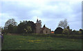
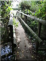
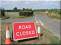
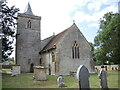
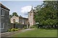
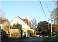
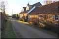
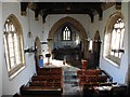
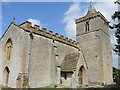
15 photos from this area
Area Information
Key information about the BA22 7PA including its size, population, and administrative classification.
- Area Type
- Postcode
- Area Size
- 43.8 hectares
- Population
- 1669
- Population Density
- 104 people/km²
House Prices in BA22 7PA
22
Properties
£470,250
Average Sold Price
£84,000
Lowest Price
£810,000
Highest Price
Showing 22 properties
| Address | Type | Beds | Baths | Last Sale Price | Last Sale Date | |
|---|---|---|---|---|---|---|
| Ayres House, Church Path, Queen Camel, Yeovil, BA22 7PA | Detached | 4 | 2 | £810,000 | Nov 2025 | |
| Little Wales, Church Path, Queen Camel, Yeovil, BA22 7PA | house | - | - | £276,250 | Dec 2022 | |
| Vine Cottage, Church Path, Queen Camel, Yeovil, BA22 7PA | Detached | 4 | 2 | £540,000 | Feb 2016 | |
| Dairy Court, Church Path, Queen Camel, Yeovil, BA22 7PA | house | 6 | - | £641,000 | Dec 2011 | |
| The Vale, Church Path, Queen Camel, Yeovil, BA22 7PA | Detached | - | - | £84,000 | Aug 1995 | |
| Wales Lodge, Church Path, Queen Camel, Yeovil, BA22 7PA | house | 5 | 3 | - | - | |
| The Old Kennels, Church Path, Queen Camel, Yeovil, BA22 7PA | Bungalow | 4 | - | - | - | |
| Ansteys, Church Path, Queen Camel, Yeovil, BA22 7PA | Bungalow | 3 | - | - | - | |
| Wales Farm, Church Path, Queen Camel, Yeovil, BA22 7PA | Unknown | - | - | - | - | |
| Wales Farm House, Church Path, Queen Camel, Yeovil, BA22 7PA | Detached | - | - | - | - |
Page 1 of 3
Energy Efficiency in BA22 7PA
Amenities
Schools
| Rank | School | Type | Entry gender | Ages |
|---|
Explore more schools in this area
Go to Schools tabDemographics
Household Size
Two person
most common
Accommodation Type
Houses
most common
Tenure
73
majority
Ethnic Group
White
most common
Religion
N/A
most common
Household Composition
N/A
most common
Age
47
median
Adults (30-64 years)
most common
Household Deprivation
N/A
with no deprivation
NS-SEC
39
in Lower managerial occupations
Explore more demographic insights in this area
Go to Demographics tabPlanning
Planning Constraints
- Flood RiskPremium
- Ramsar Wetland SitesPremium
- Area of Outstanding Natural BeautyPremium
- Protected Nature ReservePremium
- Protected WoodlandPremium