Area Overview for BA22 7LH
Photos of BA22 7LH

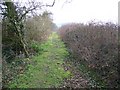
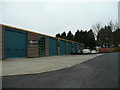
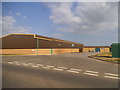
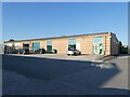

12 photos from this area
Area Information
Key information about the BA22 7LH including its size, population, and administrative classification.
- Area Type
- Postcode
- Area Size
- 2.6 km²
- Population
- 2436
- Population Density
- 47 people/km²
House Prices in BA22 7LH
30
Properties
£467,000
Average Sold Price
£264,000
Lowest Price
£670,000
Highest Price
Showing 30 properties
| Address | Type | Beds | Baths | Last Sale Price | Last Sale Date | |
|---|---|---|---|---|---|---|
| Woodlands, Cary Road, Sparkford, Yeovil, BA22 7LH | Detached | 3 | 3 | £264,000 | Sep 2022 | |
| Upperwood Dairy House, Cary Road, Sparkford, Yeovil, BA22 7LH | Detached | 5 | 3 | £670,000 | May 2022 | |
| Lewis And Cox, Unit G12, Woodside Court, Cary Road, Sparkford, Yeovil, BA22 7LH | storage_distribution | - | - | - | - | |
| Unit 1E, Sparkford Sawmills Ltd, Cary Road, Sparkford, Yeovil, BA22 7LH | Industrial | - | - | - | - | |
| Banz, Unit D2, Cadbury Business Park, Cary Road, Sparkford, Yeovil, BA22 7LH | storage_distribution | - | - | - | - | |
| Unit 1B, Sparkford Sawmills Ltd, Cary Road, Sparkford, Yeovil, BA22 7LH | shop | - | - | - | - | |
| Unit 2A, Sparkford Sawmills Ltd, Cary Road, Sparkford, Yeovil, BA22 7LH | Industrial | - | - | - | - | |
| Unit 1, Camelot Works, New Link Road, Sparkford, Yeovil, BA22 7LH | Industrial | - | - | - | - | |
| Unit C, Cadbury Business Park, Cary Road, Sparkford, Yeovil, BA22 7LH | warehouse | - | - | - | - | |
| Unit G2, Woodside Court, Cary Road, Sparkford, Yeovil, BA22 7LH | Office | - | - | - | - |
Page 1 of 3
Energy Efficiency in BA22 7LH
Amenities
Schools
| Rank | School | Type | Entry gender | Ages |
|---|
Explore more schools in this area
Go to Schools tabDemographics
Household Size
Two person
most common
Accommodation Type
Houses
most common
Tenure
79
majority
Ethnic Group
White
most common
Religion
N/A
most common
Household Composition
N/A
most common
Age
47
median
Adults (30-64 years)
most common
Household Deprivation
N/A
with no deprivation
NS-SEC
41
in Lower managerial occupations
Explore more demographic insights in this area
Go to Demographics tabPlanning
Planning Constraints
- Flood RiskPremium
- Ramsar Wetland SitesPremium
- Area of Outstanding Natural BeautyPremium
- Protected Nature ReservePremium
- Protected WoodlandPremium