Area Overview for BA22 7HZ
Photos of BA22 7HZ
Area Information
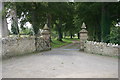
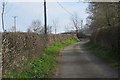
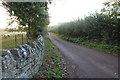
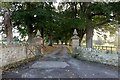
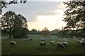
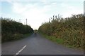
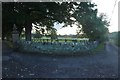
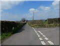
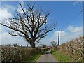
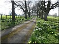
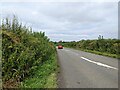
Living in BA22 7HZ places you within the village of Sparkford, a civil parish situated in Somerset near the junction of the A303. This specific postcode cluster covers 10.4 hectares and accommodates a population of 1669 residents. You live in an area defined by its history as a continuous settlement dating back to Roman and Saxon times, evident in names recorded in the Domesday Book of 1086. The village functions as a quiet residential hub where the parish includes the nearby settlement of Weston Bampfylde. Historical records show the manor passed through notable families, with the Bennett family acquiring the estate in 1610 and constructing a new manor house in 1853. Today, the most visible historical landmark is the Church of St Mary Magdalene, a Grade II* listed building originally from the 14th century that was rebuilt in 1824. The former rectory, which served as an egg packing station during World War II, now stands as private housing. This small rural community offers a distinct environment where modern connectivity meets deep-rooted local history. The location provides direct road links via the A303, positioning it effectively along the road from London to Exeter without the congestion of major urban centres.
- Area Type
- Postcode
- Area Size
- 10.4 hectares
- Population
- 1669
- Population Density
- 104 people/km²
Homes in BA22 7HZ form a market dominated by private ownership. Statistically, 73 per cent of households in this specific postcode cluster own their residences. This significant majority contrasts with rental-heavy areas found in nearby university towns or metropolitan cities. The predominant accommodation type is houses, meaning you will primarily encounter detached, semi-detached, and terraced homes rather than flats or apartments. This housing stock aligns with the village character of Sparkford and its inclusion of the parish of Weston Bampfylde. Buying here offers stability to elongate homeownership tenure. The limited size of the postcode area, covering only 10.4 hectares, means the housing supply is fixed and cannot expand easily. This scarcity often supports stable values for those who secure a property. The lack of flat options reinforces the suburban or rural nature of the build. Potential buyers should note that the market is driven by owner-occupiers rather than investors or landlords. The value proposition lies in securing a standalone house in a low-density environment where rental demand does not depress house prices. The mix of historic manor houses on the outskirts and standard village dwellings creates varied architectural styles within a small footprint.
House Prices in BA22 7HZ
Showing 3 properties
| Address | Type | Beds | Baths | Last Sale Price | Last Sale Date | |
|---|---|---|---|---|---|---|
| Park Cottage, Sutton Montis Road, Weston Bampfylde, Yeovil, BA22 7HZ | house | - | - | - | - | |
| Springfields, Sutton Montis Road, Weston Bampfylde, Yeovil, BA22 7HZ | Detached | - | - | - | - | |
| Weston Bampfylde Manor, Higher Farm Lane, Weston Bampfylde, Yeovil, BA22 7HZ | Detached | 3 | - | - | - |
Energy Efficiency in BA22 7HZ
Residents of BA22 7HZ enjoy amenities within practical reach that cater to daily needs. Retail options include Budgens Lydford, Morrisons Daily Castle, and two Co-op branches, one at Castle Cary. These five retail locations provide access to groceries and essential goods without requiring long car journeys. The area lies near RNAS Yeovilton, a significant airfield that sometimes influences local traffic but also adds a unique regional landmark. Three rail stations exist nearby: Castle Cary Railway Station, Sherborne Railway Station, and Yeovil Pen Mill Railway Station. These stations facilitate travel beyond the Somerset borders. The village itself features the Church of St Mary Magdalene, a historic landmark that serves as a spiritual focal point. The former rectory has been repurposed as private housing, altering the landscape from institutional to residential. Shopping trips are short; you can reach the Castle Centre from the postcode area quickly via the main road. This accessibility allows you to maintain access to high-street charm while enjoying village life. The combination of local shops, rail links, and historical sites creates a balanced lifestyle where convenience meets heritage.
Amenities
Schools
Families living in BA22 7HZ have access to several educational establishments, including both state-funded and independent options. Nearby schools feature Countess Gytha Primary School, a primary institution with an Ofsted rating of good. King's Bruton Pre-Preparatory School and Hazlegrove Preparatory School operate as independent preparatory institutions. This mix means you can choose between a maintained primary school with a verified standard of education or private preparatory options. The presence of two independent schools suggests a local desire for alternative educational pathways often associated with specific pedagogical approaches or smaller class sizes. However, the clear distinction is that only Countess Gytha Primary School holds the publicly accessible Ofsted rating currently listed in the data. You may need to travel beyond the immediate 10.4 hectare cluster for secondary schooling, as the listed options are all primary or preparatory in focus. This configuration supports young families with younger children well while requiring further research for older students. The variety of school types provides flexibility for parents looking to tailor their child's education. Geographic proximity to these institutions adds convenience to daily routines without requiring long commutes for young learners.
| Rank | School | Type | Entry gender | Ages |
|---|
Explore more schools in this area
Go to Schools tabDemographics
The community in BA22 7HZ reflects a mature, established neighbourhood with a median age of 47 years. Adults between the ages of 30 and 64 constitute the most common age range. You are likely to find a populated area where three quarters of households, or 73 per cent, own their homes free from rental obligations. This high level of home ownership indicates a settled population with a strong attachment to the locality. The prevailing accommodation type consists of houses, aligning with the character of Sparkford as a village rather than a terrace-dwelling urban street. Ethnically, the predominant group within this postcode area is White. A small fraction of the population comprises other ethnic groups. The area features a low population density of 104 people per square kilometre, suggesting spacious surroundings rather than crowded streets. This demographic profile supports a quiet lifestyle where families and mature residents form the core of the local society. The presence of over-30 residents correlates with the variety of schools nearby, supporting both young children and those seeking secondary education in surrounding towns. The stability of such a demographic often translates to fewer transient residents and a consistent community feel year-round.
Household Size
Accommodation Type
Tenure
Ethnic Group
Religion
Household Composition
Age
Household Deprivation
NS-SEC
Explore more demographic insights in this area
Go to Demographics tabPlanning
Planning Constraints
- Flood RiskPremium
- Ramsar Wetland SitesPremium
- Area of Outstanding Natural BeautyPremium
- Protected Nature ReservePremium
- Protected WoodlandPremium